Shotley Peninsula to Pin Mill Circular Walk
![]()
![]() Starting from Shotley, this circular walk takes you along the banks of the Stour, with good views of Harwich. Cutting back across rolling farmland to Chelmondiston, you then follow the Orwell downstream, opposite Levington, before cutting back up to Shotley.
Starting from Shotley, this circular walk takes you along the banks of the Stour, with good views of Harwich. Cutting back across rolling farmland to Chelmondiston, you then follow the Orwell downstream, opposite Levington, before cutting back up to Shotley.
A nice combination of countryside and riverside walking, with opportunities for pub stops on the way, the most notable being at Pin Mill. Here you will find the 17th century Butt and Oyster pub with great views over the little boats in the River Orwell.
The walk makes use of the Suffolk Coast Path for part of the way. You could extend your walk by following the long distance path north west from Chelmondiston to the nearby Woolverstone Park.
Shotley Peninsula Ordnance Survey Map  - view and print off detailed OS map
Shotley Peninsula Open Street Map  - view and print off detailed map
*New* - Walks and Cycle Routes Near Me Map - Waymarked Routes and Mountain Bike Trails>>
Shotley Peninsula OS Map  - Mobile GPS OS Map with Location tracking
Shotley Peninsula Open Street Map  - Mobile GPS Map with Location tracking
Pubs/Cafes
On the route head to the Butt and Oyster pub in Pin Mill. The pub dates from the 17th century and features in the Swallows and Amazons book series by Arthur Ransome, who patronised the inn himself. You can find the pub at postcode IP9 1JW for your sat navs.
Back in Shotley village there's The Rose to visit. The pub dates back to 1860 and serves good pub grub. There's also a garden area for warmer days.
Dog Walking
The river and country paths make for a nice dog walk and the Rose pub mentioned above is also dog friendly.
Further Information and Other Local Ideas
On the opposite side of the river on the northern side of the peninsula you can pick up the Levington Walk. The route starts from the nearby village and visits Levington Creek and the delightful Nacton Shores which you can see from this walk. In the village there's also an historic 16th century church and a 14th century thatched pub for refreshment.
For more walking ideas in the area see the Suffolk Walks page.
Cycle Routes and Walking Routes Nearby
Photos
Shotley Marina entrance lock. At low water, as here, only small vessels are able to enter and leave the entrance lock. The larger yacht on the landing stage beyond will have to wait until the tide turns and rises a metre or so. The lock gates are beginning to close in order to raise the water level to the height in the marina.
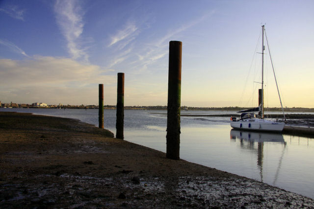
Shotley Marina approach channel. Seen here at low water, the mud and shingle banks can be seen on either side of the dredged channel in the approach to Shotley Marina, at the confluence of the Stour and Orwell rivers. A yacht waits on the landing stage for the tide to turn, to be able to enter the lock. The three posts, which are high enough to remain exposed at high water, indicate the eastern edge of the channel.
Bloody Point at low water. At low water the rocks and shingle at Bloody Point are exposed, south-east of the entrance lock to Shotley Marina. In the distance the busy Felixstowe Docks can be seen. 'Bloody Point', at the confluence of the rivers Orwell and Stour, is believed to have been named after the naval battle of 885 when King Alfred fought the Danish invaders.
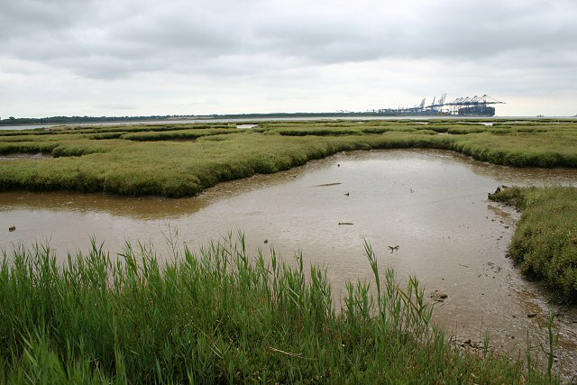
Crane's Creek on the eastern side of the peninsula. A network of inlets fills at high water, but as the tide recedes large areas of mud flats are exposed. The River Orwell can be seen as a thin blue strip in the background, beyond which loom the ship-to-shore gantry cranes at Felixstowe's Trinity Terminal.
River Orwell foreshore. Here at Crane's Creek the foreshore consists of mudflats which are mostly covered at spring tides. The town of Harwich is silhouetted on the horizon.
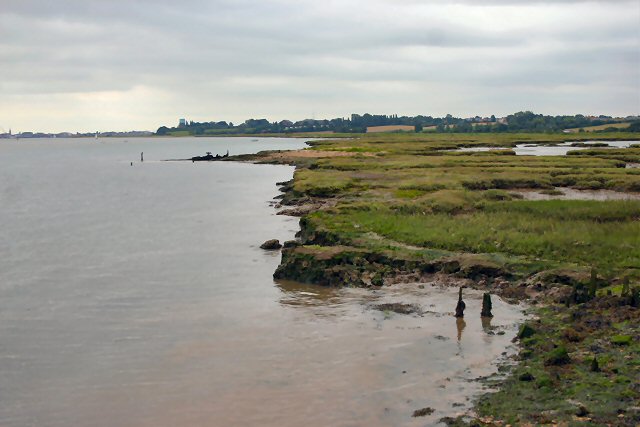
The Orwell near Collimer Point on the north eastern tip of the peninsula. A receding tide reveals the main channel just after it has turned to the south. Felixstowe docks in the background. Nearby is the remains of Collimer Hard. There are a number of 'hards' on both banks of the River Orwell. They consist of compacted stone and ballast, usually marked by wooden posts. Although seldom used nowadays, they are relics of former landing points.


