Sidmouth to Budleigh Salterton Walk
![]()
![]() This walk takes you along a lovely section of the South West Coast Path from Sidmouth to Budleigh. It's about an mile walk on undulating paths with some moderate climbs near the start.
This walk takes you along a lovely section of the South West Coast Path from Sidmouth to Budleigh. It's about an mile walk on undulating paths with some moderate climbs near the start.
The walk starts on the sea front in Sidmouth and follow the waymarked trail south west along the beach to the popular Ladram Bay. This opening section also climbs to High Peak, an elevated area about a mile south west of the town. It's over 500 feet above sea level so there are fine views over the surrounding countryside and coast. At Ladram Bay you will find a series of photogenic sandstone sea stacks in a lovely bay with a small beach.
The trail continues south past Chiselbury Bay before coming to the River Otter and the Otter Estuary just outside Budleigh. It's a scenic spot with lots of wildlife to look out for in the estuary. Shortly after crossing the river you will arrive in Budleigh Salterton where the route finishes.
Sidmouth to Budleigh Salterton Walk Ordnance Survey Map  - view and print off detailed OS map
Sidmouth to Budleigh Salterton Walk Open Street Map  - view and print off detailed map
Sidmouth to Budleigh Salterton Walk OS Map  - Mobile GPS OS Map with Location tracking
Sidmouth to Budleigh Salterton Walk Open Street Map  - Mobile GPS Map with Location tracking
Further Information and Other Local Ideas
To continue your walking in the area, head east along the coast path to visit Branscombe and Beer on the Sidmouth to Beer Walk. This passes the splendid Donkey Sanctuary in Salcombe Regis. This free tourist attraction includes a series of walkways taking you around the site and providing plenty of opportunities to interact with the resident donkeys. There's also a fine restaurant with wonderful views over the surrounding countryside.
For more walking ideas in the area see the Devon Walks page.
Cycle Routes and Walking Routes Nearby
Photos
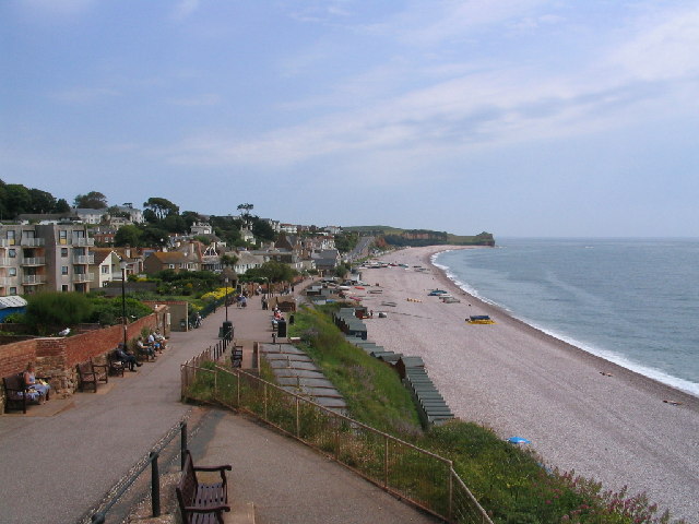
The Esplanade, Sidmouth. Looking in an easterly direction. The building on the left is named "Blossom House".
Ladram Bay. Beyond the cattle feeder. the caravan park to the left runs down to the bay, which is partly in this square and partly in SY0985. Peak Hill is prominent behind with Big Picket Rock in the sea to the right.
Otter estuary. These pine trees on the east side of the Otter estuary feature in many paintings and pictures of the Budleigh Salterton area. The shingle bank blocking the estuary is an extension of the Budleigh pebble beds, a distinct geological layer lying on top of the Triassic old red sandstone seen on the cliffs behind.


