Snodland Walks
![]()
![]() This riverside town is located in the borough of Tonbridge and Malling in Kent.
This riverside town is located in the borough of Tonbridge and Malling in Kent.
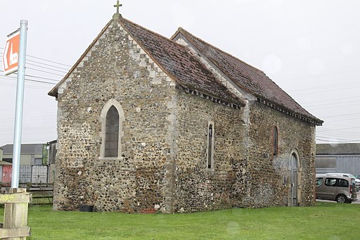
It's an historic place with Tudor Mulberry Cottages on the High Street and a church dating to the 12th century.
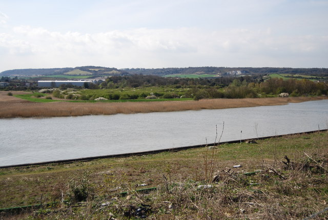
This walk from Snodland train station visits the Holborough Marshes Nature Reserve. The reserve is located next to the River Medway and includes grazing marsh with lots of wildfowl to look out for. It's a nice place for a stroll with good views across the river to the surrounding countryside. Keep your eyes peeled for nightingales and a variety of dragonflies in the summer months.
To continue your walking around Snodland you could head to neighbouring Aylesford where there's some fine riverside walks, an old priory, a medieval castle and the splendid Museum of Kent Life to visit.
Just to the east there's Blue Bell Hill where you can enjoy some wonderful views over the town and the surrounding North Downs countryside.
To the south is Leybourne Lakes Country Park where there's some fine waterside cycling and walking routes to try.
Postcode
ME6 5FB - Please note: Postcode may be approximate for some rural locationsSnodland Ordnance Survey Map  - view and print off detailed OS map
Snodland Open Street Map  - view and print off detailed map
Snodland OS Map  - Mobile GPS OS Map with Location tracking
Snodland Open Street Map  - Mobile GPS Map with Location tracking
Walks near Snodland
- Aylesford - This delightful Kentish village is a fine spot for riverside walks and access to the North Downs countryside
- Medway Valley Walk - This is a lovely, easy riverside walk along the River Medway from Tonbridge to Rochester
- Maidstone River Walk - A nice riverside walk along the Medway from Maidstone to Leybourne Lakes Country Park
- Leybourne Lakes Country Park - Enjoy peaceful, waterside walking and cycling at Leybourne Lakes Country Park, near Maidstone in Kent
- Rochester - This lovely riverside walk takes you from Rochester to Aylesford along the River Medway
- Blue Bell Hill - Visit the Blue Bell Hill viewpoint on this circular walk on the North Downs Way near Chatham
- Medway Megaliths - This interesting walk visits the site of a number of Early Neolithic chambered long barrows and megalithic monuments located in the lower valley of the River Medway, near Chatham.
The circular walk starts from the car park at the Blue Bell Hill picnic site, just to the south of the village - North Downs Way - This beautiful trail starts in Farnham, Surrey and heads east through the stunning North Downs to the historic city of Canterbury in Kent
- Bearsted - This attractive Kent based village has a pretty village green, a local community run woodland park and easy access to the footpaths on the North Downs.
- Hollingbourne - This attractive Kent based village has some fine trails through the North Downs to try
- Hucking Estate - Enjoy a peaceful stroll through the ancient woodland and open grassland of the Hucking Estate in the Kent Downs AONB
- Detling Hill - This walk climbs to Detling Hill, just to the east of the village of Detling in Kent
- Upnor - This walk visits Lower and Upper Upnor on the River Medway near Rochester in Kent.
Pubs/Cafes
The Freemasons Arms dates to 1753 and serves good quality dishes. They have an excellent outdoor area with a covered Pergola and patio area which can accommodate seating for over one hundred customers. You can find them at 267 Malling Road Snodland, ME6 5JR. They have a large car park and are also dog friendly.
Photos
Coastal Pill Box on the River Medway. There are many examples of these World War Two pill boxes along the river Medway, which was considered one of the major risks of enemy landing during the Second World War. Today, the surrounding area is known as Holborough marshes and is managed by Kent Wildlife Trust.
On footpath from Ladds Lane to Church Field. Managed by the Kent Wildlife Trust. This is an area of tidal (salt water) reedbeds and freshwater marshland. The grassland is grazed by farm animals to control invasive vegetation. In summer, nightingales and warblers can be heard in the scrub. Ducks and wading birds feed and roost in the flooded areas in the winter.
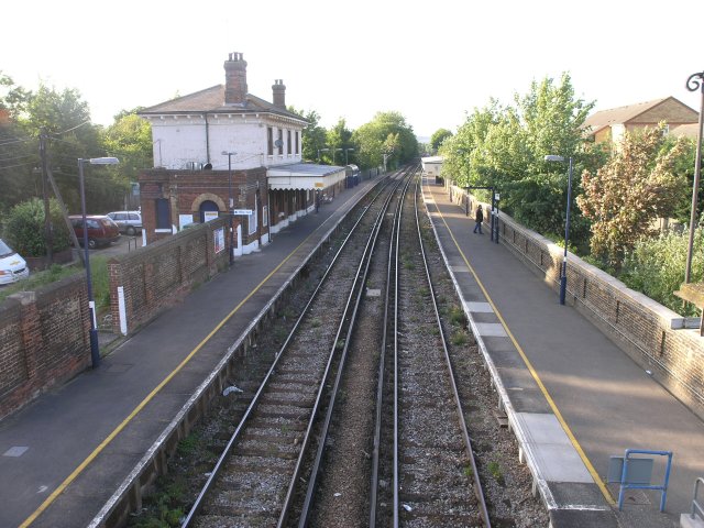
Snodland Railway Station on the on the Medway Valley Line. The typical off-peak service in trains per hour is:2 tph to Strood and 2 tph to Paddock Wood via Maidstone West.
A small number of morning, mid afternoon and late evening trains continue beyond Paddock Wood to Tonbridge.
The station is also served by two peak hour high speed services in each direction between London St Pancras International and Maidstone West.


