Upnor Walks
![]()
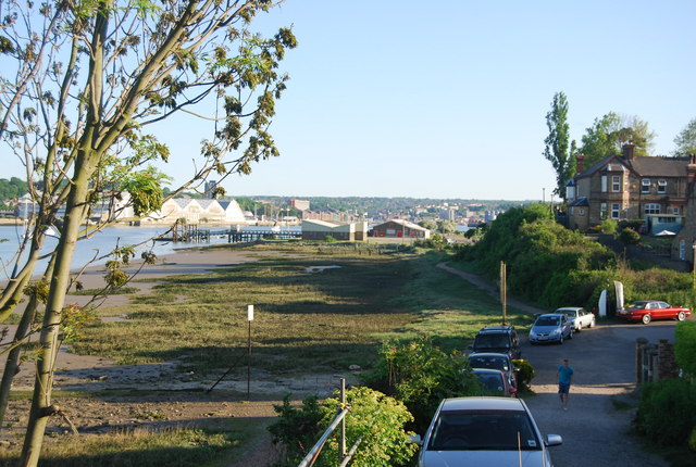
![]() This walk visits Lower and Upper Upnor on the River Medway near Rochester in Kent.
This walk visits Lower and Upper Upnor on the River Medway near Rochester in Kent.
The area includes English Heritage's Upnor Castle, a 16th century fortification with an interesting history.
The walk starts from the public car park at Lower Upnor and follows a section of the Saxon Shore Way south to the castle and Upper Upnor. The Elizabethan artillery fort was begun in 1559 and redeveloped in 1599-1601, to protect warships moored at Chatham dockyards. There's lovely views across the river from the grounds here. You can also take a stroll along the quaint old high street into the village after exploring the castle.
Upnor Ordnance Survey Map  - view and print off detailed OS map
Upnor Open Street Map  - view and print off detailed map
Upnor OS Map  - Mobile GPS OS Map with Location tracking
Upnor Open Street Map  - Mobile GPS Map with Location tracking
Walks near Upnor
- Rochester - This lovely riverside walk takes you from Rochester to Aylesford along the River Medway
- Saxon Shore Way - Explore Kent's ancient coastline as you visit Iron Age hill forts, cathedrals, Martello towers, historic ports and castles on this incredible 160 mile walk
- Medway Valley Walk - This is a lovely, easy riverside walk along the River Medway from Tonbridge to Rochester
- Medway Megaliths - This interesting walk visits the site of a number of Early Neolithic chambered long barrows and megalithic monuments located in the lower valley of the River Medway, near Chatham.
The circular walk starts from the car park at the Blue Bell Hill picnic site, just to the south of the village - Leybourne Lakes Country Park - Enjoy peaceful, waterside walking and cycling at Leybourne Lakes Country Park, near Maidstone in Kent
- Mote Park - This 450 acre park in Maidstone has a lovely lakeside cycling and walking track running through it, using National Cycle Network number 177
- Cliffe Pools Nature Reserve - Enjoy a circular walk around this delightful RSPB nature reserve in the North Kent Marshes
- Riverside Country Park - Explore the Medway Estuary in 250 acres of country park in Gillingham, Kent.
- North Downs Way - This beautiful trail starts in Farnham, Surrey and heads east through the stunning North Downs to the historic city of Canterbury in Kent
- Blue Bell Hill - Visit the Blue Bell Hill viewpoint on this circular walk on the North Downs Way
- Meopham - This Kent based village has a number of local woods and parks to visit
- Camer Park - This is a short walk through Camer Country Park and into the surrounding countryside and woodland
Further Information and Other Local Ideas
To continue your walking in the area pick up the Medway Valley Walk and enjoy more riverside trails. You could also visit the ancient Medway Megaliths for some more local history.


