St Bees Head Coastal Lighthouse Walk with OS Map
![]()
![]() Enjoy a coastal walk on this beautiful headland near Whitehaven. The walk along the cliff top path from St Bees is an exhilarating experience with fabulous views of the Isle of Man and the Cumbrian mountains and coast. The area is also an RSPB Nature Reserve with the largest seabird colony in north-west England. These include Guillemots, kittiwakes, fulmars and razorbills. You may also see dolphins and porpoises.
Enjoy a coastal walk on this beautiful headland near Whitehaven. The walk along the cliff top path from St Bees is an exhilarating experience with fabulous views of the Isle of Man and the Cumbrian mountains and coast. The area is also an RSPB Nature Reserve with the largest seabird colony in north-west England. These include Guillemots, kittiwakes, fulmars and razorbills. You may also see dolphins and porpoises.
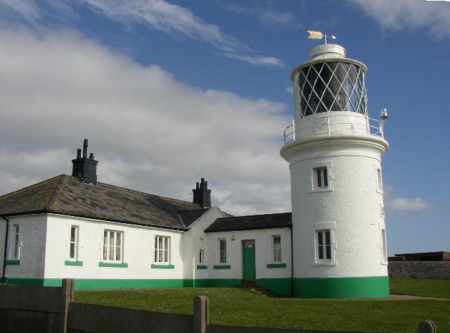
The walk starts near the village of St Bees at the coastal car park. You then head north to Fleswick Bay where you will find a nice shingle beach surrounded by high sandstone cliffs. You continue to North Head, the most westerly point of Northern England. Here you will pass St Bees Lighthouse with views towards Saltom Bay and Whitehaven. You can turn it into a longer circular walk by continuing along the coast and returning on country lanes through Sandwith and Rottington.
The Cumbria Way passes St Bees Head so you could extend your walk by following the path to nearby Whitehaven. Alternatively you could start the walk from the town which is just over 6 miles away. It's a great cliff top path with fabulous views and benches along the way to rest. The route runs for just over 6 miles with the option of catching the train back to Whitehaven at the end of the walk. See the Whitehaven to St Bees Coastal Walk for more details.
The headland is also the start point for the Wainwright's Coast to Coast Walk where you can head into the Lake District.
Postcode
CA28 9UY - Please note: Postcode may be approximate for some rural locationsSt Bees Head Ordnance Survey Map  - view and print off detailed OS map
St Bees Head Open Street Map  - view and print off detailed map
*New* - Walks and Cycle Routes Near Me Map - Waymarked Routes and Mountain Bike Trails>>
St Bees Head OS Map  - Mobile GPS OS Map with Location tracking
St Bees Head Open Street Map  - Mobile GPS Map with Location tracking
Pubs/Cafes
Head into the pretty village of St Bees for some post walk refreshments. The 17th century Queens Hotel has a cosy country pub atmosphere with oak beams and log fires in winter. They do good food which can be taken in the nice conservatory or the terraced garden bar on warmer days. They also provide accommodation if you need to stay over. You can find the hotel near the train station on 130 Main St, with a postcode of CA27 0DE for your sat navs.
Cycle Routes and Walking Routes Nearby
Photos
St Bees South Head. Four miles south of Whitehaven sits the village of St. Bees with its long sandy beach.
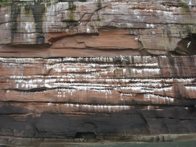
Nesting Kittiwakes on North Head. The cliffs of North Head, from Fleswick Bay northwards, have ledges eroded in the sandstone, which provide ideal nesting sites for Kittiwakes, visible only from the sea. In April or May, a sea kayak trip from St. Bees to Whitehaven gives an opportunity to see the cliff nests at very close quarters.


