Whitehaven to St Bees Coastal Walk
![]()
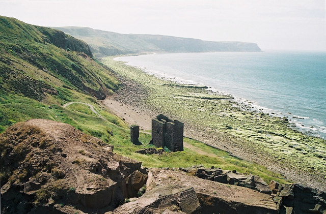
![]() This walk follows a lovely section of the Cumbria Coastal Way from Whitehaven to St Bees via the wonderful St Bees Head. It's a great cliff top path with fabulous views and benches along the way to sit and soak it all in. The route runs for just over 6 miles with the option of catching the train back to Whitehaven at the end of the walk.
This walk follows a lovely section of the Cumbria Coastal Way from Whitehaven to St Bees via the wonderful St Bees Head. It's a great cliff top path with fabulous views and benches along the way to sit and soak it all in. The route runs for just over 6 miles with the option of catching the train back to Whitehaven at the end of the walk.
The route starts by the West Pier and harbour in Whitehaven and heads south past Hurd Rocks and the South Beach. You continue south to Kells where you'll can pass the old site of the Haig Colliery Mining Museum. Some of the buildings are being used by West Cumbria Mining as its main operating base whilst it test drills for coal off the Cumbrian coast.
The path continues south to the splendid headland at St Bees Head. Here you can enjoy fabulous views of the Isle of Man and the Cumbrian mountains and coast. The area is also an RSPB Nature Reserve with the largest seabird colony in north-west England. These include Guillemots, kittiwakes, fulmars and razorbills.
The final section takes you along the cliffs at South Head before coming into St Bees village. The village includes a nice promenade, a 19th-century railway station, a 16th-century road bridge and the fascinating St Bees Priory which dates from the Norman period.
St Bees is the start point for the epic Wainwright's Coast to Coast long distance walk. You can pick up the trail and head east into the Lake District to extending your walking around St Bees.
Continuing south along the coast path will take you to Braystones, Sellafield and Seascales.
Whitehaven to St Bees Coastal Walk Ordnance Survey Map  - view and print off detailed OS map
Whitehaven to St Bees Coastal Walk Open Street Map  - view and print off detailed map
Whitehaven to St Bees Coastal Walk OS Map  - Mobile GPS OS Map with Location tracking
Whitehaven to St Bees Coastal Walk Open Street Map  - Mobile GPS Map with Location tracking
Pubs/Cafes
In the village of St Bees you could head to the 17th century Queens Hotel which has a cosy country pub atmosphere with oak beams and log fires in winter. They do good food which can be taken in the nice conservatory or the terraced garden bar on warmer days. They also provide accommodation if you need to stay over. You can find the hotel near the train station on 130 Main St, with a postcode of CA27 0DE for your sat navs.


