St Martha's Hill
![]()
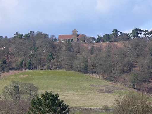
![]() This circular walk visits the lovely St Martha's Hill in the North Downs, near Guildford. From the high points there are tremendous views of the Surrey Hills and Newlands Corner.
This circular walk visits the lovely St Martha's Hill in the North Downs, near Guildford. From the high points there are tremendous views of the Surrey Hills and Newlands Corner.
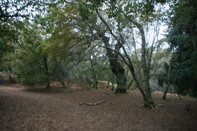
The walk starts from the St Martha's Hill, Guildford Lane Car Park, just east of the hill. You then follow the North Downs Way to the high point and the 19th century church of St Martha's. The hill summit stands at 574 feet (175 m) and commands wonderful views of the surrounding area. There are also a number of nice woodland trails, attractive grassland and a number of interesting plants.
If you'd like to extend your walk then you could visit the nearby Newlands Corner for more great views and woodland footpaths. Our 9 mile circular walk from the pretty village of Shere visits the hill after passing Newlands Corner.
Just to the west is Chantry Wood where there are some more nice woodland trails and meadows to explore. From the eastern end of the woods you can enjoy a climb to Pewley Down.
Footpaths leading south from the hill will take you to Blackheath Common where there's nice footpaths and cycle trails to follow through the attractive heathland and woodland.
Postcode
GU5 9BQ - Please note: Postcode may be approximate for some rural locationsSt Martha's Hill Ordnance Survey Map  - view and print off detailed OS map
St Martha's Hill Open Street Map  - view and print off detailed map
St Martha's Hill OS Map  - Mobile GPS OS Map with Location tracking
St Martha's Hill Open Street Map  - Mobile GPS Map with Location tracking
Pubs/Cafes
Just to the east at Newland's Corner you can enjoy some post walk refreshments at The Plucky Pheasant. The cafe serves a good range of meals and snacks which you can enjoy with a view from the lovely garden. You can find them at postcode GU4 8SE for your sat navs.
Dog Walking
The hill and surrounding woodland are ideal for a dog walk. The cafe mentioned above is also dog friendly.
Further Information and Other Local Ideas
Just to the south of the hill you can pick up the Chilworth Gunpowder Mills Walk. This historical trail takes you along the River Tillingbourne to the ruins of several old Gunpowder Mills. The mills were originally established in 1625 by the East India Company and finally closed in 1920. They became an important supplier of gunpowder to the Government during the 17th, 18th and 19th centuries. It's an impressive sight with a number of buildings to explore and informations boards detailing the history of the area. You can access the trail about half a mile south of the hill on Blacksmith Lane at a postcode of GU4 8NQ.
The circular Godalming Walk starts from the nearby town and climbs to the hill before exploring the surrounding area on various waymarked trails.
For more walking ideas in the area see the North Downs Walks page.
Cycle Routes and Walking Routes Nearby
Photos
St Martha's Hill church is capped with Carstone. This is a sandstone of the Folkestone Sands deposited around 100 million years ago. It was hardened when water with iron in it percolated downwards to form an iron oxide called limonite. Much of exterior of the church has been faced with locally quarried Carstone whose rusty colour can be seen in this photograph
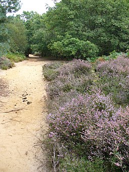
This wide sandy path on the hill doubles up here as parts of both Downs Link and North Downs Way. It is popular with cyclists, riders and walkers as it passes through heather and deciduous woodland.


