Stratford Greenway
![]()
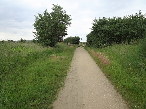
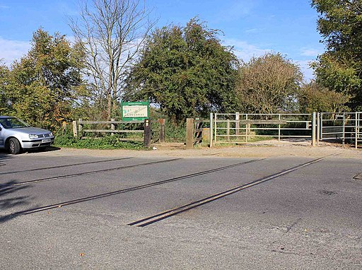
![]() This 5 mile cycling and walking trail runs along a disused railway line from Stratford Upon Avon to Long Marston. The greenway follows the route of the old Honeybourne Line passing the Stratford Upon Avon Racecourse before crossing the River Avon and the River Stour. You then pass Milcote where there is a nice picnic area with a refurbished railway carriage cafe. It's about half way along the route so a nice place to stop for refreshments. The final section takes you through the countryside to the finish point at the village of Long Marston.
This 5 mile cycling and walking trail runs along a disused railway line from Stratford Upon Avon to Long Marston. The greenway follows the route of the old Honeybourne Line passing the Stratford Upon Avon Racecourse before crossing the River Avon and the River Stour. You then pass Milcote where there is a nice picnic area with a refurbished railway carriage cafe. It's about half way along the route so a nice place to stop for refreshments. The final section takes you through the countryside to the finish point at the village of Long Marston.
The path is flat and well surfaced so it's an ideal ride for families or anyone looking for an easy traffic free ride.
If you would like to continue your exercise in the Stratford Upon Avon area you could pick up the towpath of the Stratford Upon Avon Canal and enjoy a waterside cycle or walk.
For walkers the long distance Avon Valley Footpath and Monarch's Way both run through the area.
Postcode
CV37 9AL - Please note: Postcode may be approximate for some rural locationsStratford Greenway Ordnance Survey Map  - view and print off detailed OS map
Stratford Greenway Open Street Map  - view and print off detailed map
*New* - Walks and Cycle Routes Near Me Map - Waymarked Routes and Mountain Bike Trails>>
Stratford Greenway OS Map  - Mobile GPS OS Map with Location tracking
Stratford Greenway Open Street Map  - Mobile GPS Map with Location tracking
Pubs/Cafes
On the route you could stop off at the Carriages Cafe at Milcote. Here you'll find a nice little cafe housed in the old railway carriages. They serve good lunches and can be found on the route at postcode CV37 8JW.
At the end of the route there's also the Mason's Arms in Long Marston. The inn dates back to 1685 and includes two lovely garden areas to relax in on warmer days. They do a fine Sunday roast and can be found on Welford Road at postcode CV37 8RG for your sat navs.
Dog Walking
The path is ideal for an easy dog walk so you'll probably see other owners on your visit. It's best to keep them on leads or under close control due to the bikes sharing the path. The Mason's Arms pub mentioned above is also dog friendly.
Further Information and Other Local Ideas
Stratford Bike Hire is located near the start of the route, just of the greenway. You can hire a good ranges of cycles here for your outing.
Cycle Routes and Walking Routes Nearby
Photos
Railway Bridge on the Stratford Greenway. Old railway bridge over the River Avon south-west of Stratford on the Greenway walking/cycling path to Long Marston
Chambers Crossing Halt railway station (site). Opened in 1904 by the Great Western Railway, on what became the line from Cheltenham to Stratford-upon-Avon, this station doubled in size in 1908 when a second track and platform were provided. It closed in 1916. View north towards Stratford-upon-Avon Racecourse platform and Stratford-upon-Avon.


