Snitterfield Walks
![]()
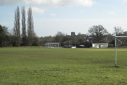
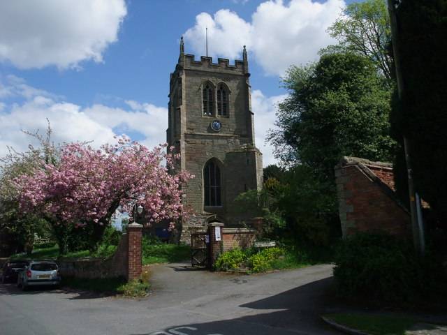
![]() This pretty Warwickshire village is directly on one of the UK's major waymarked footpaths. There's also a wildlfie rich local nature reserve and a good village pub to enjoy refreshments after your exercise.
This pretty Warwickshire village is directly on one of the UK's major waymarked footpaths. There's also a wildlfie rich local nature reserve and a good village pub to enjoy refreshments after your exercise.
The settlement was formely known as 'Snytenfeld' meaning 'open field of Snipe'. It recieved the name due to a large population of the wading birds inhabiting the meadows near the Sherborne Brook that runs through the village.
This walk from the village follows the Monarch's Way south to visit Welcombe Hills Country Park before continuing to Stratford Upon Avon.
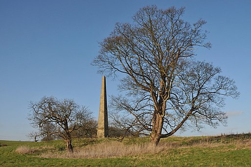
The walk starts in the village where you can pick up the waymarked long distance trail and follow it south through the countryside to the Welcombe Hills, passing Snitterfield Reservoir on the way. There's some excellent views from this elevated park. The area is also a nature reserve with grassland, woodland and ponds.
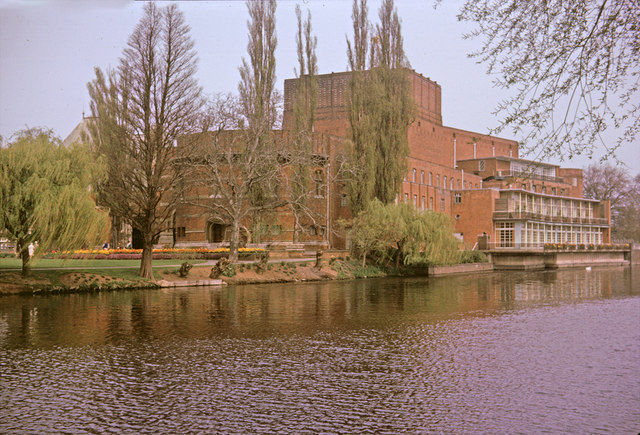
After enjoying the views the route continues south into Stratford, finishing at the famous Royal Shakespeare theatre next to the River Avon.
Postcode
CV37 0JH - Please note: Postcode may be approximate for some rural locationsSnitterfield Ordnance Survey Map  - view and print off detailed OS map
Snitterfield Open Street Map  - view and print off detailed map
*New* - Walks and Cycle Routes Near Me Map - Waymarked Routes and Mountain Bike Trails>>
Snitterfield OS Map  - Mobile GPS OS Map with Location tracking
Snitterfield Open Street Map  - Mobile GPS Map with Location tracking
Walks near Snitterfield
- Stratford Upon Avon Canal - Enjoy waterside cycling and walking on this 26 mile canal which runs from Stratford Upon Avon to Birmingham
- Stratford Upon Avon River Walk - The Warwickshire town of Stratford Upon Avon is famously associated with William Shakespeare
- Welcombe Hills Country Park - Enjoy wonderful views over Stratford-Upon-Avon and the surrounding Warwickshire countryside in this elevated country park
- Avon Valley Footpath - This delightful riverside walk takes you from Stratford Upon Avon to Marlcliff
- Charlecote Park - Enjoy an easy walk around the beautiful Charlecote Park in Wellesbourne, Warwickshire
- Compton Verney - This walk explores the Capability Brown landscaped grounds surrounding this Georgian Mansion in Warwickshire.
- Oversley Wood - Follow the woodland trails through the delightful forest on this circular walk in Alcester
- Coughton Court - Explore the beautiful gardens of the Tudor Coughton Court, before a lovely waterside stroll along the River Arden on this walking route in Warwickshire
- Bidford on Avon - This delightful Warwickshire village has some lovely river and country trails to enjoy
- Inkberrow - This pretty Worcestershire village includes a picturesque village green, a historic church and a fine local pub
- Henley in Arden Circular Walk - This circular walk explores the villages, rivers, canals and countryside surrounding the charming town of Henley in Arden in Warwickshire
- Warwick - A circular walk around the town of Warwick, visiting the castle, the River Avon and the Grand Union Canal.
- Stratford Greenway - This 5 mile cycling and walking trail runs along a disused railway line from Stratford Upon Avon to Long Marston
- Ragley Hall - This walk explore the Ragley Hall estate in Arrow, Warwickshire
Pubs/Cafes
Head to the Snitterfield Arms for some refreshments in the village. The pub serves fine food and has a lovely garden with views of the village and surrounding area. You can find them on Bearley Road at postcode CV37 0JH for your sat navs.
Dog Walking
The country and parkland trails make for a fine dog walk. The Welcombe Hills Park and the Snitterfield Arms mentioned above are also dog friendly.
Further Information and Other Local Ideas
Just to the west of the village you could visit the Snitterfield Bushes Nature Reserve. The reserve has some nice woodland trails with lots of pretty bluebells to see in the spring. See more in the video below.
In Stratford you could enjoy an easy waterside walk along the Stratford Upon Avon Canal. On the way you can visit the Edstone Aqueduct, the longest cast iron aqueduct in England. This lies just a few miles west of the village.
For more walking ideas in the area see the Warwickshire Walks page.


