Summerbridge Walk
![]()
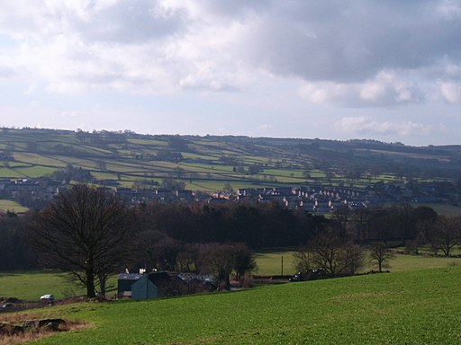
![]() This pretty riverside village is a nice place to enjoy a walk through the surrounding countryside of the Nidderdale AONB.
This pretty riverside village is a nice place to enjoy a walk through the surrounding countryside of the Nidderdale AONB.
This circular walk from the village visits the River Nidd, Hartwith and Old Spring Wood.
The walk starts in the village on Summer Bridge where you can pick up the Nidderdale Way and follow the waymarked trail south along the Nidd. The route leaves the river near Darley, heading north to Harwith and Old Spring wood where there are some pleasant woodland trails and lots of bluebells in the spring.
You can extend the walk at Old Spring Wood by heading a couple of miles north to visit Brimham Rocks. The elevated rocks are a local highlight with some fascinating geologily and wonderful views to enjoy. Just to the west of here there's the Pateley Bridge Circular Walk where you can enjoy more waterside walking along the expansive Gouthwaite Reservoir.
Postcode
HG3 4HP - Please note: Postcode may be approximate for some rural locationsSummerbridge Ordnance Survey Map  - view and print off detailed OS map
Summerbridge Open Street Map  - view and print off detailed map
Summerbridge OS Map  - Mobile GPS OS Map with Location tracking
Summerbridge Open Street Map  - Mobile GPS Map with Location tracking
Walks near Summerbridge
- Brimham Rocks - Brimham Rocks is a National Trust owned site with a collection of fascinating rock formations
- Nidderdale Way - Explore beautiful Nidderdale in the Yorkshire Dales on this circular walk
- Pateley Bridge Circular Walk - This circular walk around the Yorkshire town of Pateley Bridge makes use of the Nidderdale Way to take you on a tour the countryside, reservoirs, rivers and woodland surrounding the town
- Gouthwaite Reservoir - This walk takes you around this delightful reservoir, near Pateley Bridge and Ramsgill
- Studley Park and Fountains Abbey - This marvellous attraction boasts 800 acres of beautiful parkland set in the Yorkshire countryside
- Ripon Rowel - This is a circular walk around the Yorkshire city of Ripon, visiting South Stainley, Markington and Masham
- Thruscross Reservoir - This is a delightful waterside walk around Thruscross Reservoir in the Yorkshire Dales
- Eavestone Lake - This circular walk in Nidderdale visits Eavestone Lake and the Picking Gill Nature Reserve
- Bolton Abbey - Explore the huge estate surrounding the ruins of this 12th-century Augustinian monastery
- Birstwith - This pretty village is located in the Harrogate district of North Yorkshire
- Hampsthwaite - This North Yorkshire based village is located in a pleasant spot on the River Nidd near Birstwith.
Pubs/Cafes
The Royal Oak at Dacre Banks is a good choice for some post walk refreshment. The pub dates back to the 18th century and is Grade II listed. Inside there's stone flagged floors, an inglenook log fire and a lounge area with views over Nidderdale. They have a good menu and a nice garden area for warmer days. You can find them at Oak Lane, Dacre Banks with postcode HG3 4EN for your sat navs.
Further Information and Other Local Ideas
Follow the Nidderdale way south east and you will soon come to the neighbouring village of Birstwith. It's a nice place for a stroll with riverside trails, an old mill, a weir, a picturesque mill race and an old packhorse bridge to see.
A few miles to the north you can pick up the Ripon Rowel and enjoy a walk around Eavestone Lake.
For more walking ideas in the area see the Nidderdale Walks page.


