Walks in Sunderland
![]()
![]() This famous port city in Tyne and Wear has some nice riverside and coastal walking trails to try. There's also local country parks, rail trails and several waymarked long distance footpaths to pick up in the area.
This famous port city in Tyne and Wear has some nice riverside and coastal walking trails to try. There's also local country parks, rail trails and several waymarked long distance footpaths to pick up in the area.
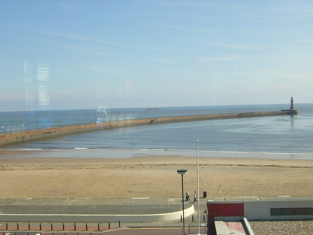
This walk takes you along the coast to visit the lighthouse on Roker Pier before heading to the neighbouring village of Whitburn.
The walk starts on the Wearmouth Bridge where you can pick up a footpath and cycleway running east along Sunderland Harbour. You'll pass the university, the marina and the North Pier before coming to Roker Beach and the Roker Pier. Here you can walk out to the lighthouse and enjoy views back to the city. On this opening section you will also pass a number of sculptures next to the River Wear.
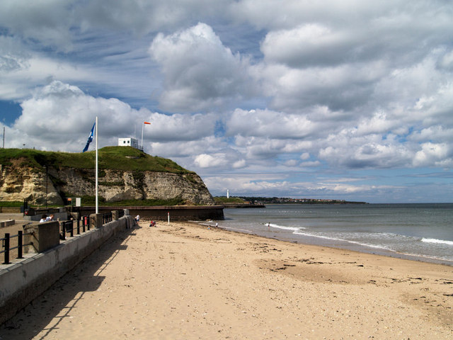
At the pier you can pick up the Weardale Way and follow the waymarked footpath north along the coast. You'll pass Parson's Rocks, Seaburn and South Bents before coming to Whitburn. Here you could extend the walk by continuing north to visit Souter Lighthouse and Whitburn Coastal Park. Head further north and there's the National Trust's Marsden Rocks and the South Shields coast where there are a series of interesting geological formations to see. You could also climb to the Cleadon Hills and enjoy fine views over the area.
Sunderland Ordnance Survey Map  - view and print off detailed OS map
Sunderland Open Street Map  - view and print off detailed map
Sunderland OS Map  - Mobile GPS OS Map with Location tracking
Sunderland Open Street Map  - Mobile GPS Map with Location tracking
Walks near Sunderland
- Weardale Way - Follow the River Wear from the coast at Sunderland to Killhope Lead Mining Museum in the Pennines
- Souter Lighthouse and Whitburn Coastal Park - Enjoy a coastal walk around the Souter Lighthouse, Whitburn Coastal Park and Lizard Point on the South Shields coast
- South Shields - This coastal town in Tyne and Wear sits in a fine spot at the mouth of the River Tyne.
- Consett and Sunderland Railway Path - A walk or cycle along a disused railway path from Consett to Sunderland
- Herrington Country Park - This super, large park in Sunderland has a number of cycling and walking trails and interesting environmental sculptures
- Seaham - The town of Seaham is located on the Durham Coast, just south of Sunderland
- Penshaw Monument - Climb Penshaw Hill and visit this iconic Sunderland landmark on this short walk in Tyne and Wear
- Bede's Way - Follow in the footsteps of seventh century pilgrims on this interesting walk or cycle through Tyne and Wear.
- Great North Forest Heritage Trail - This circular cycle and walking route takes you through the countryside of this former mining area in Tyne and Wear
- Beamish Woods - These pretty woods in the village of Beamish have some nice woodland trails to try
- James Steel Park - Enjoy riverside walking and cycling in this country park situated on the River Wear in Sunderland
- Chester-le-Street - This pleasant circular walk in the town of Chester-le-Street visits the riverside gardens and Lumley Castle.
You can start the walk from the parking area at the riverside park, just to the east of the city centre - Cleadon Hills - This circular walk climbs to the Cleadon Hills viewpoint above South Shields in Tyne and Wear.
Pubs/Cafes
Grannie Annies is a great choice for refreshments on the walk. It's located next to Roker Beach so you can enjoy an excellent sea view from the elevated balcony. You can find them near the start of the route at Marine Walk.
Dog Walking
The coastal and country trails make for a bracing dog walk. Grannie Annies mentioned above is also dog friendly.
Further Information and Other Local Ideas
To continue your walking around Sunderland head west to visit the iconic Penshaw Monument. There are great views over the city from the elevated position of the monument.
For more walking ideas in the area see the Tyne and Wear Walks page.


