Souter Lighthouse and Whitburn Coastal Park
![]()
![]() Enjoy a coastal walk around the Souter Lighthouse, Whitburn Coastal Park and Lizard Point on the South Shields coast. The park and lighthouse are located just to the south of South Shields at the village of Marsden. You can park at the Souter Lighthouse car park off the A183 at Marsden Quarry to start your walk. Alternatively follow the traffic free cycle and walking path along National Cycle Route 1 from South Shields to the site. It's a nice trail passing Frenchman's Bay, Marsden Bay and the Leas. The park is also just a few miles north of Sunderland and can be reached by walking or cycling along the same National route.
Enjoy a coastal walk around the Souter Lighthouse, Whitburn Coastal Park and Lizard Point on the South Shields coast. The park and lighthouse are located just to the south of South Shields at the village of Marsden. You can park at the Souter Lighthouse car park off the A183 at Marsden Quarry to start your walk. Alternatively follow the traffic free cycle and walking path along National Cycle Route 1 from South Shields to the site. It's a nice trail passing Frenchman's Bay, Marsden Bay and the Leas. The park is also just a few miles north of Sunderland and can be reached by walking or cycling along the same National route.
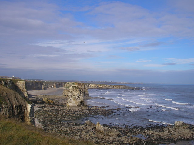
This route starts at the lighthouse car park and heads to the coastal viewpoint at Lizard Point. You then head west along the coast to Marsden Cliff and the Leas. Here you will find two and a half miles of magnesian limestone cliffs, wave-cut foreshore and coastal grassland. It's a fine cliff top walk with great views along the coast.
After exploring the Leas the route turns round and returns to Whitburn Coastal Park. The park is a nature reserve with trees, a bird observatory, viewing screens and wetland habitats. There's also a new National Trust wildlife garden with ponds, wildflowers, trees, berry bearing shrubs, a bog garden and hibernation areas.
The reserve is great for wildlife watching with cormorants, shags, kittiwakes, fulmar and herring gulls.
At the end of your walk you can enjoy refreshments at the National Trust cafe.
The long distance Great North Forest Heritage Trail runs through Marsden so you can pick this up to extend your walk. It will take you inland towards Cleadon Park and Boldon.
You could also head south along the traffic free cycle path to Whitburn Bay and Sunderland.
Postcode
SR6 7NH - Please note: Postcode may be approximate for some rural locationsPlease click here for more information
Souter Lighthouse and Whitburn Coastal Park Ordnance Survey Map  - view and print off detailed OS map
Souter Lighthouse and Whitburn Coastal Park Open Street Map  - view and print off detailed map
Souter Lighthouse and Whitburn Coastal Park OS Map  - Mobile GPS OS Map with Location tracking
Souter Lighthouse and Whitburn Coastal Park Open Street Map  - Mobile GPS Map with Location tracking
Explore the Area with Google Street View 
Further Information and Other Local Ideas
To extend your walk you could try the longer South Shields Walk which starts at the mouth of the Tyne and visits South Shields Lighthouse, the South Pier, Ocean Beach pleasure Park, and Trow Point before heading to the lighthouse.
The Cleadon Hills Walk starts from the car park near the lighthouse. The circular walk will take you up to an old mill and viewpoint to the west of the park.
For more walking ideas in the area see the Tyne and Wear Walks page.
Cycle Routes and Walking Routes Nearby
Photos
Souter Lighthouse from the East. Now owned by the National Trust the lighthouse was opened in 1871 and was the first to use alternating current which gave much better reliability than direct current. The dark window on the left was an innovation designed to provide a fixed two colour light across Sunderland Bay. Ships would steer along the white sector before turning into the port of Sunderland; if the light turned red they had drifted too close to the rocks.


