Tadworth Walks
![]()
![]() This Surrey based village is surrounded by some lovely North Down scenery.
This Surrey based village is surrounded by some lovely North Down scenery.
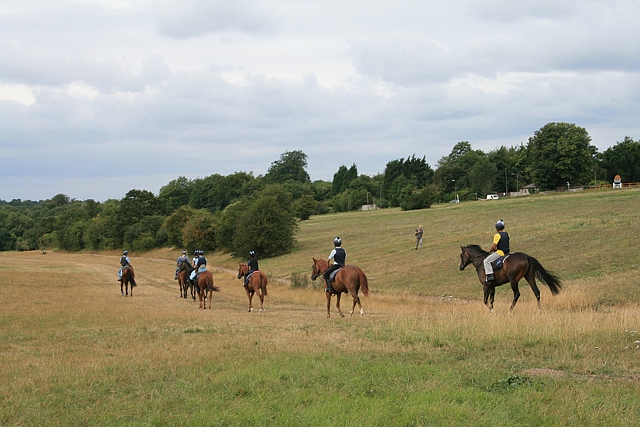
It sits right on the edge of Banstead Heath where there are miles of good walking and cycling trails to try. To the north is Epsom Downs where you can enjoy views of the famous Epsom Racecourse.
This circular walk starts from the train station and visits these two local highlights using a series of good public footpaths. There's much to enjoy with peaceful woodland trails and moderate hill climbs providing excellent views over the surrounding countryside.
Postcode
KT20 5RX - Please note: Postcode may be approximate for some rural locationsTadworth Ordnance Survey Map  - view and print off detailed OS map
Tadworth Open Street Map  - view and print off detailed map
Tadworth OS Map  - Mobile GPS OS Map with Location tracking
Tadworth Open Street Map  - Mobile GPS Map with Location tracking
Walks near Tadworth
- Banstead Heath - This large open space in Banstead has lots of walking trails to follow
- Banstead Downs - This walk crosses Banstead Downs Site of Special Scientific Interest in Surrey
- Banstead Woods - These lovely woods in Surrey have miles of well marked walking paths and a nature trail to follow
- Epsom Downs - This circular walk takes you around Epsom Downs racecourse in Surrey
- Epsom Common - Follow this cycle and walking track around this large open space in Surrey
- Ashtead Common National Nature Reserve - This 500 acre ancient wooded common is also a National Nature Reserve
- Thames Down Link - This walk links the Thames Path and North Downs Way National Trails
- Colley Hill - Climb to the 722 ft (220 m) summit of Colley Hill on this walk in the North Downs
- Reigate and Banstead Millennium Trail - This splendid walk was devised by Reigate and Banstead Borough Council to celebrate the new millennium
- Reigate Hill and Gatton Park - This circular walk explores Reigate Hill and Gatton Park in the North Downs
- Reigate Heath - This walk explores Reigate Heath on the western side of the town
- Betchworth - This small village is located near Dorking in Surrey
- Brockham - This award winning village sits in a fine spot in the Mole Valley of Surrey
- Horton Country Park - This country park and nature reserve is located near Epsom in Surrey
- Leatherhead - The town of Leatherhead is in a good position for walking, situated on the edge of the North Downs and Surrey Hills AONB
- Walton on the Hill - This Surrey based village is located near Tadworth in the North Downs.
Pubs/Cafes
The Grumpy Mole is in a lovely spot for some post exercise refreshment. The black and white Edwardian pub is set back from the main road on a small green where you can sit outside and enjoy a meal in fine surroundings. You can find them on the Dorking Road at postcode KT20 5RX.
Further Information and Other Local Ideas
Head a little south of Banstead Heath and you could enjoy a climb to the viewpoint on Colley Hill. You can also pick up the North Downs Way here.
Photos
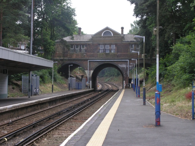
Tadworth Station. There are two national rail stations, Tadworth close to the centre of the village and for some residents Tattenham Corner railway station is nearer, adjoining Epsom Downs. Both are in Oyster card Zone 6 and are run by the Southern Railway.
Tadworth Court is a grand Grade I listed building and was built at the height of Queen Anne style architecture in the very early 18th century – namely here in 1700 for Leonard Wessels, Lord of the Manor of Banstead. It is the home of the Children's Trust, a national charity providing special care for severely disabled children and rehabilitation to children with acquired brain injuries.


