Thaxted Walks
![]()
![]() This attractive Essex based town is a very pleasant place for a stroll. There's a number of historic half timbered houses, a 14th century Guildhall, 16th century almshouses and a picturesque windmill to admire. There's also a series of good countryside footpaths with scenic views of the River Chelmer to enjoy in the surrounding area.
This attractive Essex based town is a very pleasant place for a stroll. There's a number of historic half timbered houses, a 14th century Guildhall, 16th century almshouses and a picturesque windmill to admire. There's also a series of good countryside footpaths with scenic views of the River Chelmer to enjoy in the surrounding area.
This walk from the town follows a section of the Harcamlow Way south to Dutton Hill and the remains of the abbey and mill at Tilty.
The walk starts in the village where you can pick up the Harcamlow Way and follow the waymarked footpath south towards the windmill. You continue past Stanbrook and Follymill before coming to Dutton Hill and Tilty. Here you can enjoy views of the old Tilty mill and the ruins of Tilty Abbey which dates back to the 12th century.
Postcode
CM6 2LT - Please note: Postcode may be approximate for some rural locationsThaxted Ordnance Survey Map  - view and print off detailed OS map
Thaxted Open Street Map  - view and print off detailed map
Thaxted OS Map  - Mobile GPS OS Map with Location tracking
Thaxted Open Street Map  - Mobile GPS Map with Location tracking
Pubs/Cafes
The Maypole is a good choice for some post walk refreshment. The stylish pub does a great Sunday roast and has a nice garden area to sit out in on warmer days. You can find them at 31 Mill End with postcode CM6 2LT for your sat navs.
Dog Walking
The country trails make for a fine dog walk and the Maypole mentioned above is also dog friendly.
Further Information and Other Local Ideas
On the northern side of the town you can pick up the circular Turpin's Trail. The waymarked paths will take you to nearby Great Sampford and Hempstead, the birthplace of Highwayman Dick Turpin.
If you follow the Harcamlow Way north west you could visit Saffron Walden and the splendid Audley End park. The long distance Icknield Way Path and the Saffron Trail can also be picked up in this area.
To the south there's the expansive Hatfield Forest, Great Dunmow and the Flitch Way, a shared cycling and walking trail along a disused railway line.
A few miles to the west you'll find Clavering where there's a noteworthy 14th century church and some delightful almshouses dating back to the 15th century. You'll also pass picturesque Arkesden which is well worth exploring.
For more walking ideas in the area see the Essex Walks page.
Cycle Routes and Walking Routes Nearby
Photos
Thaxted Railway Station. The station closed to passengers on 15th September 1952 and completely on 1st June 1953 well before the Beeching "Axe". It was the terminus of a branch line from Elsenham. What remains are the main station building with the shelter for passengers and an engine shed nearby.
Thaxted Almshouses. Single storey almshouses by St.John the Baptist's church with John Webb's windmill in the distance The thatched building is known as The Chantry and was a priest's house until 1589 when it was converted to four almshouses. The tiled row was originally built in the early 18th century as 8 dwellings, though converted in 1975 into three.
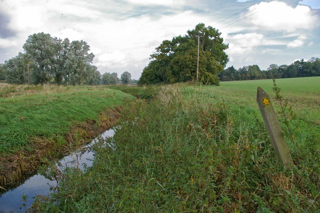
Harcamlow Way and River Chelmer, south of the town. The way-mark indicates the Harcamlow long distance footpath beside the River Chelmer at Duton Hill looking upstream.


