Thornton Steward Reservoir
![]()
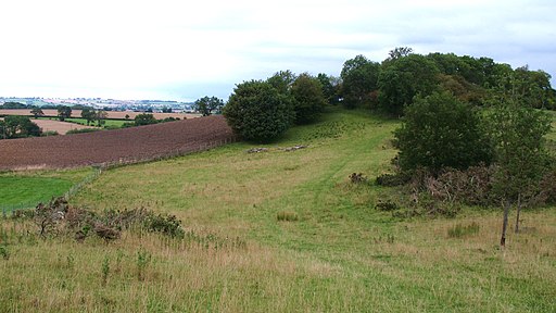
![]() This walk visits the pretty Thornton Steward Reservoir near the small village of Thornton Steward in the Wensleydale area of North Yorkshire.
This walk visits the pretty Thornton Steward Reservoir near the small village of Thornton Steward in the Wensleydale area of North Yorkshire.
You can start the walk from the car park at the southern end of the water, about half a mile north of the village. From here you can follow footpaths along the western side of the reservoir and then a series of country lanes to create a circular walk through the surrounding area. It's about a 2 mile walk so should take about 40 minutes to an hour.
The area is very peaceful with lovely views across the still waters to the surrounding countryside and hills.
Just to the south you'll find one of the historic highlights of the area at Jervaulx Abbey which is well worth a visit. On the way you'll pass the village of Thornton Steward where there's some interesting old buildings to admire.
Postcode
HG4 4BQ - Please note: Postcode may be approximate for some rural locationsThornton Steward Reservoir Ordnance Survey Map  - view and print off detailed OS map
Thornton Steward Reservoir Open Street Map  - view and print off detailed map
Thornton Steward Reservoir OS Map  - Mobile GPS OS Map with Location tracking
Thornton Steward Reservoir Open Street Map  - Mobile GPS Map with Location tracking
Further Information and Other Local Ideas
To continue your reservoir walking in the area head to the nearby Leighton Reservoir where there's another pleasant waterside path to try.
Just a few miles to the north is the noteworthy village of Constable Burton where you can enjoy lovely trails around Constable Burton Hall. The grade-I-listed Georgian mansion includes some beautiful grounds with peaceful woodland, pretty becks and delightful gardens to see.
For more walking ideas see the Nidderdale Walks and the Yorkshire Dales Walks pages.


