Trent Lock
![]()
![]() This circular walk explores the countryside and waterways surrounding Trent Lock in Long Eaton. It's a significant location as the lock marks the point where the River Trent and River Soar meet with the beginning of the Erewash canal. It also sits on the border of three counties: Leicestershire, Nottinghamshire and Derbyshire. On the route you'll visit the Trent and Mersey Canal, Sawley Marina and the River Soar. The route runs for about 8 miles on a series of flat footpaths making it ideal for an easy afternoon stroll.
This circular walk explores the countryside and waterways surrounding Trent Lock in Long Eaton. It's a significant location as the lock marks the point where the River Trent and River Soar meet with the beginning of the Erewash canal. It also sits on the border of three counties: Leicestershire, Nottinghamshire and Derbyshire. On the route you'll visit the Trent and Mersey Canal, Sawley Marina and the River Soar. The route runs for about 8 miles on a series of flat footpaths making it ideal for an easy afternoon stroll.
Start the walk from the Trentlock car park at the end of Lock Lane, just to the south of Long Eaton town centre. From here you can pick up waterside footpaths heading west to Sawley Bridge Marina. The marina is notable as the largest Inland Marina in the United Kingdom with a water space of 23 acres. It's a lovely spot with lots of boats and a nice cafe where you could stop for some refreshments. The cafe has a good menu and outdoor seating with views of the marina.
At the marina you can pick up the Midshires Way and follow it south east toward Ratcliffe on Soar. Here you can pick up a footpath running north along the River Soar. Follow this up to the canal and lock before turning south west to follow country paths back to the Midshires Way. You can then follow this back to Sawley Marina before heading east along the canal back to the car park.
To continue your walking from the lock head north east along the river to visit the lovely Attenborough Nature Reserve where there a series of lakes and lots of wildlife to enjoy. The Beeston Canal can also be picked up at the eastern end of the reserve. If you head west you can visit Shardlow where there's another pretty marina and a circular walk using the canal and the River Trent.
Trent Lock Ordnance Survey Map  - view and print off detailed OS map
Trent Lock Open Street Map  - view and print off detailed map
Trent Lock OS Map  - Mobile GPS OS Map with Location tracking
Trent Lock Open Street Map  - Mobile GPS Map with Location tracking
Pubs/Cafes
The aptly named Trent Lock pub is beautifully positioned next to the lock. There's a great menu and a lovely, large beer garden to sit out in. You can find it at the lock with a postcode of NG10 2FY.
The Steamboat Inn is also located at Trent Lock and another nice place to go for refreshments. It's located next to both the Erewash Canal and the River Trent, dating back over 200 years to when it was well placed to quench the thirsts of passing working boatmen. Today, it is perfectly placed to serve not just the needs of leisure boaters but also those of other modern day recreation seekers such as walkers, cyclists - and those just having a day out by the water. It's dog friendly and a discount on real ales is available for CAMRA members! There's lots of waterside outdoor seating for warmer days as well. You can find it at postcode NG10 2FY for your sat navs.
Further Information and Other Local Ideas
Just to the south you'll find the worthy village of Kegworth where you can enjoy a stroll along a canalised section of the River Soar. There's also the splendid Sutton Bonnington Hall to visit in this area.
To the north west there's some nice waterside trails around St Chad's Water and Church Wilne Reservoir. St Chad's includes a nice circular lakeside footpath with a wildflower meadow and the historic 13th century St Chad's Church.
Cycle Routes and Walking Routes Nearby
Photos
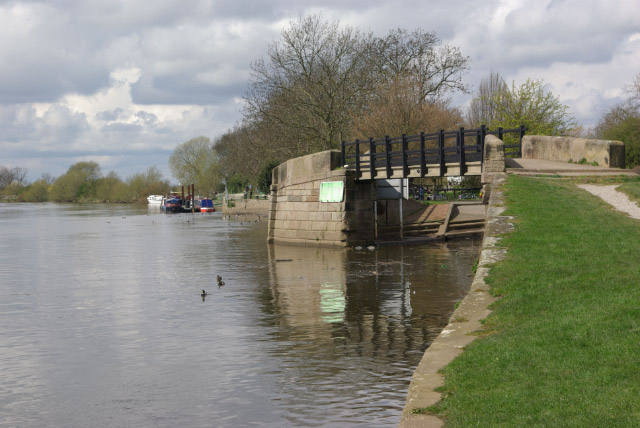
Trentlock. The river yacht and houseboats moored on the opposite bank are hardly typical of the canal network, but Trentlock is a place where river and canal craft mix. This is the attractive start of the almost 12-mile long Erewash Canal; much of the route runs through an urban and industrial landscape but it is nevertheless a fascinating waterway.
River Trent near Trent Lock. The south bank of the river is far less frequented than the northern, due to the lack of direct road access!
River Trent at the lock. Looking upstream; the bridge marks the start of the Erewash Canal which will take boaters almost 12 miles up the Erewash Valley to Langley Mill.


