Long Eaton Walks
![]()
![]() This Derbyshire based town has some nice waterside walking along the canals and river that run through the area.
This Derbyshire based town has some nice waterside walking along the canals and river that run through the area.
This walk from the town uses sections of the Erewash Canal and the Trent and Mersey Canal to visit the popular Trent Lock and the village of Shardlow.
The walk starts in the town centre where you can pick up the Erewash Canal and follow the towpath south to Trent Lock. It's a noteworthy spot as it marks the point where the River Trent and River Soar meet with the beginning of the Erewash canal. It also sits on the border of three counties: Leicestershire, Nottinghamshire and Derbyshire.
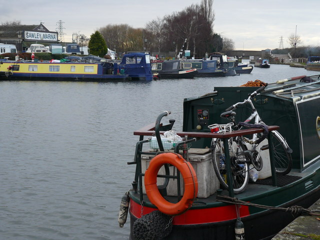
At the lock you head west along the river and canal to visit the Sawley Marina and Shardlow. The village is considered Britain's most complete surviving example of a canal village, with over 50 Grade II listed buildings and a large number of surviving public houses.
Postcode
NG10 4QB - Please note: Postcode may be approximate for some rural locationsLong Eaton Ordnance Survey Map  - view and print off detailed OS map
Long Eaton Open Street Map  - view and print off detailed map
*New* - Walks and Cycle Routes Near Me Map - Waymarked Routes and Mountain Bike Trails>>
Long Eaton OS Map  - Mobile GPS OS Map with Location tracking
Long Eaton Open Street Map  - Mobile GPS Map with Location tracking
Walks near Long Eaton
- Ilkeston - A walk from the Derbyshire town of Ilkeston visiting the nearby Shipley Country Park
- Erewash Canal - Follow the Erewash canal through south Derbyshire on this waterside cycling and walking route
- Trent and Mersey Canal - Follow the Trent and Mersey Canal through Derbyshire, Staffordshire and Cheshire on this long distance waterside walk
- Shardlow - This circular walk around Shardlow takes you along the Trent and Mersey Canal and the River Derwent
- Trent Lock - This circular walk explores the countryside and waterways surrounding Trent Lock in Long Eaton
- Castle Donington - This historic market town in Leicestershire, is located near the National Forest, just north of East Midlands Airport
- Nutbrook Trail - This easy cycling and walking trail runs from Long Eaton to Heanor along the Erewash Canal and a dismantled railway line
- Shipley Country Park - This large country park near Ilkeston boasts 700 acres of attractive and varied landscape
- Trent Valley Way - Follow the River Trent from Long Eaton in Derbyshire to West Stockwith in Nottinghamshire on this lovely waterside walk
- Kegworth - This large Leicestershire based village has some nice canal and country trails to try.
- Nottingham Canal - Enjoy a walk or cycle along this pretty canal in Nottingham
- Cossall - This walk from the village of Cossall takes you to the Nottingham Canal Nature Reserve
- St Chad's Water and Church Wilne Reservoir - This walk visits St Chads Water Local Nature Reserve and Church Wilne Reservoir in Draycott in the Erewash district of Derbyshire.
Pubs/Cafes
The Mill & Brook is located in a nice spot near the canal. The friendly pub serves good food and has a small garden area out the back. You can find them on Derby Road at postcode NG10 4QB.
Dog Walking
The waterside trails make for a fine dog walk and the Mill & Brook mentioned above is also dog friendly.
Further Information and Other Local Ideas
If you head north along the canal you could visit the neighbouring town of ref='/routes/home.nsf/RoutesLinksWalks/ilkeston-walking-route'>Ilkeston. Just east of Ilkeston there's some more nice waterside trails along the Nottingham Canal Nature Reserve at Cossall. The pretty village also includes a noteworthy 13th century church and the 17th century Willoughby Almshouses.
To the south there's the market town of Castle Donington. Here you can visit Donington Park which is famously used as a motor racing track and is also the venue for the Download Music Festival.
Just to the west there's some nice waterside trails around St Chad's Water and Church Wilne Reservoir. St Chad's includes a nice circular lakeside footpath with a wildflower meadow and the historic 13th century St Chad's Church.
For more walking ideas in the area see the Derbyshire Walks page.
Photos
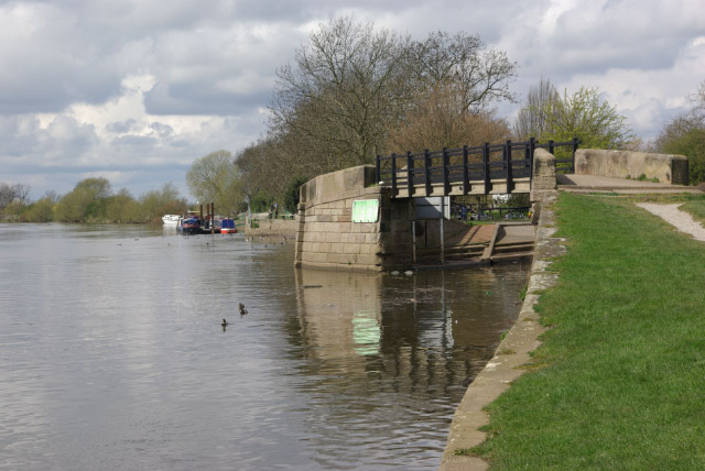
River Trent, Trent Lock. Looking upstream; the bridge marks the start of the Erewash Canal which will take boaters almost 12 miles up the Erewash Valley to Langley Mill.
Bridge Mills, Long Eaton. In 2007 the conservation area which covers the major remaining lace mills of Long Eaton was extended. The appraisal document for this prepared in October 2005 by Sue Blakeley describes this mill thus: "This collection of buildings is the most complete as a group as the various sheds survive on this site alongside the main factory building. Built in 1902 by Francis Perks to the designs of a local builder, John Sheldon Bridge Mills was the last multi storey, steam powered tenement lace factory to be built in Long Eaton and was in fact constructed after the town already had its first electrically powered lace factory building. Bridge Mills also had a north light shed to the west of the site which took its power by line shafting across the yard between the two buildings."
Long Eaton Hall. A fine Palladian mansion house, built for the Howitt family in 1778 to the designs of the noted Derby based architect Joseph Pickford. The ornate entrance is almost identical to that of Pickford's own house at 41 Friar Gate, Derby - excepting the masonic frieze that appears on his own home. The hall is now the town hall and offices for the local council. Despite the obvious gardening work taking place, it is fair to say that the council are not the most sympathetic guardians of such a fine historic building.


