Trimley Marshes
![]()
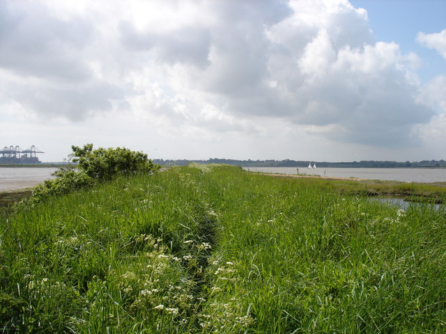
![]() Follow the circular trail around this lovely nature reserve near Felixstowe. There's over 200 acres to explore on a series of good footpaths. It's one of the premiere wildlife watching spots in England with a huge variety of water loving birds to look out for. This includes coot, tufted duck, teal, pochard, cormorant, little egrets, gadwall and shoveler. The reserve includes a series of lagoons and lakes with additional waterside paths along the River Orwell. There's also large areas of reedbeds and lovely views across the estuary to enjoy.
Follow the circular trail around this lovely nature reserve near Felixstowe. There's over 200 acres to explore on a series of good footpaths. It's one of the premiere wildlife watching spots in England with a huge variety of water loving birds to look out for. This includes coot, tufted duck, teal, pochard, cormorant, little egrets, gadwall and shoveler. The reserve includes a series of lagoons and lakes with additional waterside paths along the River Orwell. There's also large areas of reedbeds and lovely views across the estuary to enjoy.
You can park at the car park at the end of Codry's Lane and pick up the paths from here. Trimley St Mary rail station is also very close by.
The Stour and Orwell Walk runs through the reserve so you can continue along this path to extend your walk. Heading west will take you to Levington and then on to Orwell Country Park. Here you'll find over 200 acres of woodland and parkland with more nice footpaths to follow.
Also nearby is the delightful Nacton Shores with its beach and river views.
Postcode
IP11 0UD - Please note: Postcode may be approximate for some rural locationsTrimley Marshes Ordnance Survey Map  - view and print off detailed OS map
Trimley Marshes Open Street Map  - view and print off detailed map
Trimley Marshes OS Map  - Mobile GPS OS Map with Location tracking
Trimley Marshes Open Street Map  - Mobile GPS Map with Location tracking
Further Information and Other Local Ideas
Head west along the river path and you could pick up the circular Levington Walk which starts from the nearby village and visits Levington Creek and the delightful Nacton Shores. In the village there's also an historic 16th century church and a 14th century thatched pub for refreshment.
For more walking ideas in the area see the Suffolk Walks page.


