Twyning Circular Walk
![]()
![]() A circular walk around the Gloucestershire village of Twyning, visiting the River Avon and the River Severn. It's a lovely, scenic area with riverside meadows, common land and some fine views from the high points on the walk.
A circular walk around the Gloucestershire village of Twyning, visiting the River Avon and the River Severn. It's a lovely, scenic area with riverside meadows, common land and some fine views from the high points on the walk.
The walk starts in the village and heads a short distance to the east to meet up with the River Avon. You can then follow Shakespeare's Avon Way south towards The Mythe near Tewkesbury. You could head south here to visit the marinas and St John's Bridge in the town. This route heads north along the river towards Queenhill, passing the former clay pits at Mythe Hook and the viewpoint at Mythe Tute.
The route then turns east to visit the village of Ripple. From here you follow country lanes south past Towbury Hill Fort before turning east to Puckrup and then on to Twyning.
Twyning Ordnance Survey Map  - view and print off detailed OS map
Twyning Open Street Map  - view and print off detailed map
Twyning OS Map  - Mobile GPS OS Map with Location tracking
Twyning Open Street Map  - Mobile GPS Map with Location tracking
Pubs/Cafes
The Fleet Inn is located in a lovely spot east of the village on the river. There's a huge beer garden, and heated pergola terrace where you can enjoy views over the water with your meal. You can find them on Fleet Lane, with postcode GL20 6FL for your sat navs. During the summer months boats also ferry people up the river Avon from Tewkesbury to enjoy the Fleet's hospitality.
Dog Walking
The river and country trails make for a fine dog walk and the Fleet Inn mentioned above is also dog friendly.
Further Information and Other Local Ideas
Head north and you will soon come into Worcester where you can pick up the Worcester Riverside Walk. In the famous city you can also enjoy a visit to the historic Worcester Cathedral.
Along the way you'll pass close to the delightful village of Hanley Swan. The picturesque settlement includes a pretty village green, a pond, a 17th century pub and walking trails to neighbouring Hanley Castle where you can see the remains of the ancient fort. The river trails and historic 16th century pub at Upton Upon Severn are also located in this area.
The circular walk from Ashton Under Hill to the picture postcard village of Elmley Castle and the fine viewpoint at Bredon Hill lies just a few miles to the east.
Also to the east is the worthy village of Kemerton where there are two wildlife rich nature reserves to explore. The village is very pretty with the 16th century Kemerton Court and a Grade II listed church to see as well. Near here there's also the Beckford Nature Reserve with its bluebell woods and lakeside paths.
Cycle Routes and Walking Routes Nearby
Photos
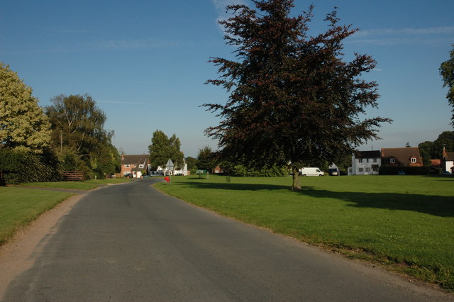
Twyning Green is one of a number of commons in the parish of Twyning, however, these days it is not grazed by livestock.
Narrow boat on the River Avon at Twyning. Taken from the public access point next to the Fleet Inn (from beneath a flowering cherry tree) where the ferry crossed the river.
View from Mythe Tute Mythe Tute, also known as Royal Hill after a visit by George III and Queen Charlotte in the eighteenth century, is a motte high above the River Severn on Mythe Hill. The western part of the motte has got as a result of erosion of the cliff above the river. In this view Mythe Bridge can be seen and the River Severn. The River Avon meets the Severn at the bend in the river in the middle distance.


