Tyndrum to Bridge of Orchy Walk
![]()
![]() This route follows a section of the West Highland Way from Tyndrum to Bridge of Orchy in the Scottish Highlands.
This route follows a section of the West Highland Way from Tyndrum to Bridge of Orchy in the Scottish Highlands.
The walk runs for just under 7 miles and includes some moderate climbs.
You start in the village of Tyndrum where there are two train stations on The West Highland Line railway.
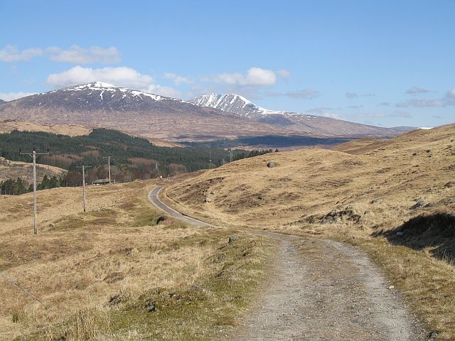
Follow the waymarked trail north along the Old Military Road and it will take you past Beinn Odhar and Beinn Dorain in the Grampian Mountains.
The route finishes with lovely views of the River Orchy at Bridge of Orchy. To extend the walk continue north to visit the glorious viewpoint at Loch Tulla which lies just a couple of miles from Bridge of Orchy. See the Bridge of Orchy to Kingshouse Walk for more details of the next leg of the journey.
Tyndrum to Bridge of Orchy Ordnance Survey Map  - view and print off detailed OS map
Tyndrum to Bridge of Orchy Open Street Map  - view and print off detailed map
Tyndrum to Bridge of Orchy OS Map  - Mobile GPS OS Map with Location tracking
Tyndrum to Bridge of Orchy Open Street Map  - Mobile GPS Map with Location tracking
Pubs/Cafes
The 4* Bridge of Orchy Hotel is a fine place to rest and relax at the end of the walk. They have a friendly bar and a fine dining room inside with a an outdoor seating area for warmer weather. You can find them at postcode PA36 4AD for your sat navs. The hotel is also dog friendly.
Further Information and Other Local Ideas
At the end of the walk you can pick up the Glen Orchy Walk and explore the beautiful Glen with its waterfalls, streams and woodland. There's also fine views of the photogenic River Orchy, one of the finest white-water rivers in the UK.
Cycle Routes and Walking Routes Nearby
Photos
Cottages of 'Clifton', Tyndrum. The village has a campsite, hotel, bunkhouse and bed and breakfasts to accommodate walkers.


