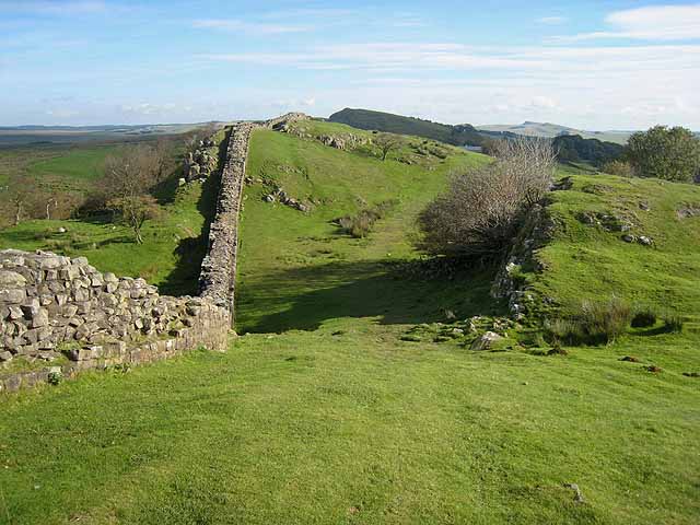
Walltown Crags
![]()
![]() Visit one of the best preserved sections of Hadrian's Wall on this short walk in Northumberland. The walk starts at the car park near Greenhead and follows the Hadrian's Wall Path to Walltown Crags. There are splendid views towards Haltwhistle and the River South Tyne.
Visit one of the best preserved sections of Hadrian's Wall on this short walk in Northumberland. The walk starts at the car park near Greenhead and follows the Hadrian's Wall Path to Walltown Crags. There are splendid views towards Haltwhistle and the River South Tyne.
The route also includes a waterside section along the Tipalt Burn, before passing through Greenhead and returning to the car park.
Postcode
CA8 7HY - Please note: Postcode may be approximate for some rural locationsWalltown Crags Ordnance Survey Map  - view and print off detailed OS map
Walltown Crags Open Street Map  - view and print off detailed map
Walltown Crags OS Map  - Mobile GPS OS Map with Location tracking
Walltown Crags Open Street Map  - Mobile GPS Map with Location tracking
Further Information and Other Local Ideas
Head west along the Hadrian's Wall Path and you will soon come to Birdoswald Roman Fort. The fort is the most impressive of the remaining defences along the Wall today. Housesteads fort with its visitor centre and museum is a little further away to the east.
If you head a few miles west along the wall there's another historic local highlight at Lanercost Priory. The English heritage run site was originally founded in 1169 as an Augustinian monastery. Today the substantial priory ruins are well worth a visit for the fascinating history and architecure.
For more walking ideas in the area see the Northumberland Walks and Northumberland National Park Walks pages.
Cycle Routes and Walking Routes Nearby
Photos
Hadrian's Wall at Walltown Crags. A particularly striking and well-preserved section of Hadrian's Wall as seen from Hadrians Wall National Trail which runs 84 miles from Bowness-on-Solway to Wallsend.
This lake is evidence of the extensive quarrying in the past along the line of Hadrian's Wall at Walltown.
View from the Crags. Looking north-east from near Turret 45A on Hadrian's Wall, one gets a feeling of infinite space in the lonely country stretching towards Wark Forest in the Kielder Forest Park.


