Warley Moor Reservoir
![]()
![]() This walk visits Warley Moor Reservoir near Ovenden Moor, Halifax. Start the walk from the Ogden Water car park which is located a couple of miles east of the reservoir.
This walk visits Warley Moor Reservoir near Ovenden Moor, Halifax. Start the walk from the Ogden Water car park which is located a couple of miles east of the reservoir.
From here you can pick up a bridleway heading west across Mixenden Ings and Round Hill to Cold Edge. Here you pick up a country lane heading north to Warley Moor. It's a very peaceful place with nice views across the moors and sailboats on the water.
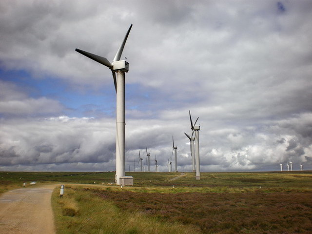
You'll also pass the Ovenden Moor Wind Farm an expansive site that can be seen from some distance over Bronte Country.
Warley Moor Reservoir Ordnance Survey Map  - view and print off detailed OS map
Warley Moor Reservoir Open Street Map  - view and print off detailed map
Warley Moor Reservoir OS Map  - Mobile GPS OS Map with Location tracking
Warley Moor Reservoir Open Street Map  - Mobile GPS Map with Location tracking
Further Information and Other Local Ideas
Also in the Halifax area is the splendid Shibden Park. The popular park has miles of trails with woodland, lakes, gardens and water features to enjoy. From here you can also explore the lovely hills and countryside of the Shibden Valley and Shibden Dale.
To the south west there's also the smaller Upper and Lower Deanhead Reservoirs. A grassy path can be followed to the two lakes.
Cycle Routes and Walking Routes Nearby
Photos
Warley Moor Reservoir. This is a catchment reservoir on Oxenhope Moor at a height of approx 400 metres. The wind farm on the skyline is on Ovenden Moor. View looking east
On the dam of Warley Moor Reservoir This dam is 900m long, and has two kinks in it, one in the distance in this view. Although not signposted, and not a right-of-way, it is possible to walk down a track to the southern end of the dam, along the top of the dam, on a path on which footbridges have been provided over streams, up a track past the northern end of the reservoir to the road, and back along the road to the starting point.
Ovenden Moor Wind Farm - just east of the reservoir. Built in the 1990s in two lines of turbines to utilise the south westerly wind, the size of these turbines are small by modern day standards.


