Wem Walks
![]()
![]() This pleasant market town in Shropshire has a couple of waymarked trails passing through it. You can use these waymarked paths to explore some attractive Shropshire countryside or enjoy waterside paths along the Roden River which runs through the town.
This pleasant market town in Shropshire has a couple of waymarked trails passing through it. You can use these waymarked paths to explore some attractive Shropshire countryside or enjoy waterside paths along the Roden River which runs through the town.
This circular walk from the town uses sections of the Shropshire Way to visit the historic Moreton Corbet Castle and the nearby viewpoint at Grinshill.
The walk starts at the train station where you can pick up the Shropshire Way and follow the waymarked footpath south east to Lee Brockhurst and the Lee Hills. Here you'll find a pleasant area of mixed woodland owned by the National Trust.
The route continues south to Papermill Bank, Stanton Upon Hine Heath and Moreton Corbet. Here you'll find the atmospheric ruins of a 16th century house and 12th century medieval gatehouse.
The route then heads west to Acton Reynald and Grinshill. The village is a nice place for a walk with a viewpoint on Grinshill and woodland trails through the adjacent Corbet Wood.
The route then heads north through the countryside to Oaklands before crossing the River Roden and returning to Wem.
Wem Ordnance Survey Map  - view and print off detailed OS map
Wem Open Street Map  - view and print off detailed map
Wem OS Map  - Mobile GPS OS Map with Location tracking
Wem Open Street Map  - Mobile GPS Map with Location tracking
Pubs/Cafes
The Castle Hotel is a good option for some post refreshment back in the town. This recently renovated coaching house dates back over 400 years. It has a nice olde worlde feel with exposed woodwork to the wall and ceilings, wood panelling, local historical photographs and a cosy stove burner. Outside there's a nice patio area for warmer weather. You can find them on the High Street with a postcode of SY4 5AA for your sat navs.
Dog Walking
The country and woodland trails on the route make for a fine dog walk. The Castle Hotel mentioned above is also dog friendly.
Further Information and Other Local Ideas
You can pick up a riverside footpath heading west from the town to visit the Ruewood Meadow Nature Reserve. The reserve is situated on the River Roden and a good place for some birdwatching near the town. There's also wet meadows and lovely widflowers to see during the spring. You can find the reserve 1 mile from the town at postcode SY4 5SH for your sat navs.
A few miles north of the town you can pick up the Llangollen Canal. You could follow the towpath west to visit Ellesmere Lake and Colemere Country Park where there are more nice waterside walking trails to try. Along the canal from Colemere there's also the Fenns, Whixall and Bettisfield Mosses National Nature Reserve. The noteworthy reserve straddles the border between England and Wales. It is a significant site being one of the biggest and best raised bogs in Britain. The area is great for flora and fauna and also includes the old Ellesmere Canal.
A few miles to the east is the worthy village of Hodnet where you could pay a visit to the delightful Hodnet Hall Gardens. There's 60 acres to explore with lakes, bluebell woodland, a Water Garden and a Kitchen Garden the highlights. The historic village also includes a noteworthy Norman church and a fine pub dating to the 16th century.
For more walking ideas in the area see the Shropshire Walks page.
Cycle Routes and Walking Routes Nearby
Photos
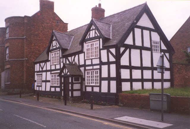
Church Hall, High Street, Wem. This was built in the early 19C as a market hall, at which time the ground floor was open and used by stall-holders.


