Wessenden Reservoir
![]()
![]() This walk visits Wessenden Reservoir and Moor in West Yorkshire. There's some fine moorland scenery and excellent views from the elevated position of the reservoirs.
This walk visits Wessenden Reservoir and Moor in West Yorkshire. There's some fine moorland scenery and excellent views from the elevated position of the reservoirs.
You can start the walk from the Wessenden Head Road Car Park located just to the east of Wessenden Head Reservoir at Pudding Real Moss. From here you can pick up a section of the Pennine Way and follow the waymarked trail west to the first of the reservoirs. Continue north west and the trail will take you along the Wessenden Brook to Great Hey Cote Hill and the northern reservoir where there's an impressive dam. You can easily extend the walk by continuing north to visit Blakeley Reservoir and Butterley Reservoir.
Postcode
HD9 4EU - Please note: Postcode may be approximate for some rural locationsWessenden Reservoir Ordnance Survey Map  - view and print off detailed OS map
Wessenden Reservoir Open Street Map  - view and print off detailed map
Wessenden Reservoir OS Map  - Mobile GPS OS Map with Location tracking
Wessenden Reservoir Open Street Map  - Mobile GPS Map with Location tracking
Pubs/Cafes
After your walk you could head north east into nearby Meltham and visit the Travellers Rest. The pub has a friendly atmosphere and is a popular place for walkers. They have a lovely large garden area where you can enjoy great views with your meal. You can find them on Slaithwaite Road with a postcode of HD9 5NH for your sat navs.
Dog Walking
The moorland area is a fine place for a dog walk so you will probably bump into other owners on a fine weekend day. The pub mentioned above is also dog friendly.
Further Information and Other Local Ideas
The circular Meltham Walk starts from the nearby town and visits the reservoirs, Meltham Moor and Deer Hill Reservoir. In the town you can also visit Meltham Mills Reservoir, Honley Woods and the lovely Folly Dolly Falls which are something of a local hidden gem. Just to the north there's Blackmoorfoot Reservoir which is a good place for spotting wildfowl.
To the west you can explore the expansive Marsden Moor.
For more walking ideas in the area see the South Pennines Walks and Peak District Walks pages.
Cycle Routes and Walking Routes Nearby
Photos
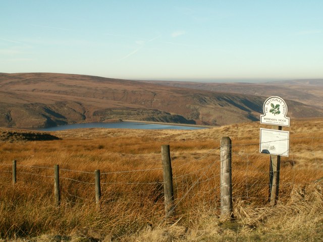
Wessenden Moor. Looking to Wessenden Head Reservoir, pic taken from Wessenden Head Road near the free car park where the route begins.
Lower Hills, Wessenden Valley, Marsden. These look like drumlins – piles of material left by the retreating glacier. The Holme Moss TV mast is on the horizon.


