West Kennet Long Barrow Walk
![]()
![]() This walk visits a particularly impressive Neolithic chambered tomb in Wiltshire. The tomb has a fascinating history dating back over 5 thousand years to around the 37th century BC.
This walk visits a particularly impressive Neolithic chambered tomb in Wiltshire. The tomb has a fascinating history dating back over 5 thousand years to around the 37th century BC.
The walk starts from the parking lay-by just to the north of the site. From here you can pick up a footpath heading south for about half a mile. It's a short climb with fine views over the area from the high points. Silbury Hill, the East Kennet Barrow, the Sanctuary and Windmill Hill are visible on a fine day. You can also explore inside the atmospheric ancient tomb and read about the history on the English Heritage supplied information boards.
Postcode
SN8 1QH - Please note: Postcode may be approximate for some rural locationsPlease click here for more information
West Kennet Long Barrow Ordnance Survey Map  - view and print off detailed OS map
West Kennet Long Barrow Open Street Map  - view and print off detailed map
*New* - Walks and Cycle Routes Near Me Map - Waymarked Routes and Mountain Bike Trails>>
West Kennet Long Barrow OS Map  - Mobile GPS OS Map with Location tracking
West Kennet Long Barrow Open Street Map  - Mobile GPS Map with Location tracking
Dog Walking
Only assistance dogs are allowed at the site.
Further Information and Other Local Ideas
Just to the north of the site you can enjoy a climb to Silbury Hill. The hill stands at a height of 30 metres (98 ft) making it the tallest prehistoric man-made mound in Europe.
About a mile or so north of the car park there's the famous Avebury Stones to explore as well.
Head east from Avebury on the Wessex Ridgeway and you will soon come to Fyfield Down National Nature Reserve and the Grey Wethers. These ancient stones are considered the best assemblage of sarsen stones in England. Also on the down you can try the Devil's Den and Grey Wethers Sarsens Stones Walk which visits a photogenic dolmen burial chamber.
The Sarsen Way passes the site. The long distance trail runs through Wiltshire from Coate Water Country Park in Swindon to Salisbury Cathedral. It passes many other fascinating ancient sites including Old Sarum Castle and the Alton Barnes White Horse on Milk Hill. The Avebury to Stonehenge Walk uses the part of the route and will take you on to the world famous Stonehenge on Salisbury Plain.
For more walking ideas in the area see the North Wessex Downs Walks page.
Cycle Routes and Walking Routes Nearby
Photos
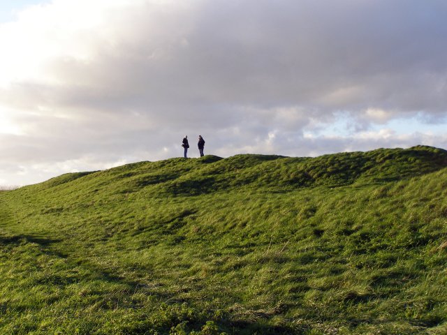
West Kennett Long Barrow earthworks. These earthworks are around 100 metres long, making it one of the longest neolithic burial mounds in Britain. Its excavated stone chambers at the eastern end usually get the most attention (see various other photographs). The long mound bears the scars of 5000 years of existence, which show up well in this low autumnal sunlight.
Path leading up to the site. West Kennett long barrow is on the ridge of a chalk hill, about half a mile to the south of Pan Bridge on the A4 road. This well-worn path up the hillside is underlaid with a plastic matrix to try and reduce wear and tear from visitors' feet - it was laid in the summer of 2005 and the grass has now re-established.


