Wilton Windmill
![]()
![]() This circular walk visits Wilton Windmill in the North Wessex Downs area of Wiltshire.
This circular walk visits Wilton Windmill in the North Wessex Downs area of Wiltshire.
It then heads through the woodland of the Wilton Brail to meet up with the Kennet and Avon Canal where you can enjoy an easy stroll along the towpath. You'll also pass the pretty Wilton Water where you can watch the birds on the lake.
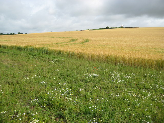
The walk starts in the centre of Wilton village though you could also start at the lay by car parking area at the windmill where there are a few spaces. It's a short stroll east from the village to the windmill along a country lane. You can then stroll around the mill which is surrounded by some lovely countryside. The mill is notable as the only working windmill in Wessex and still produces wholemeal, stone-ground flour. During the summer season there are also guided tours available on certain days.
After exploring the site you retrace your steps for about a quarter of a mile before picking up footpaths heading north east to Dodsdown and the woodland and Wilton Brail. The paths will take you up to the canal around Mill Bridge where you can pick up the towpath and follow it west to Crofton where you'll find the interesting old pumping station which dates from 1812. You can then leave the canal and follow footpaths south east to Wilton Water. In addition to providing water for the canal, which is pumped by the nearby Crofton Pumping Station, it provides a haven for wildlife. Shortly after passing the pretty lake you will return to Wilton where the walk finishes.
Postcode
SN8 3SW - Please note: Postcode may be approximate for some rural locationsPlease click here for more information
Wilton Windmill Ordnance Survey Map  - view and print off detailed OS map
Wilton Windmill Open Street Map  - view and print off detailed map
Wilton Windmill OS Map  - Mobile GPS OS Map with Location tracking
Wilton Windmill Open Street Map  - Mobile GPS Map with Location tracking
Pubs/Cafes
At the mill there's the shepherd’s hut shop, serving refreshments with a seating area as well. There's also picnic areas around the mill if you would like to bring your own food.
Back in Witlon The Swan is a fine traditional English pub located in the heart of the village. They do good food and have a lovely outdoor seating area if the weather is fine. You can find them on Grafton Road at postcode SN8 3SS for your sat navs.
Dog Walking
The area makes for a lovely dog walk with country and woodland trails to enjoy. You are asked to please keep them on leads around the windmill. The Swan pub mentioned above is also dog friendly.
Further Information and Other Local Ideas
The Great Bedwyn Walk takes you west along the canal to nearby Burbage and Pewsey.
If you follow the canal north it will take you to Little Bedwyn and then to Hungerford where you can pick up the Newbury to Kintbury and Hungerford Canal Walk.
In Pewsey you can pick up the Pewsey Avon Trail which takes you along the river to the historical city of Salisbury with its magnificent cathedral.
The Pewsey Walk will take you along the Kennet and Avon Canal Walk and then into the countryside of the Vale of Pewsey and onto Pewsey Downs where there are splendid views from the high points.
For more walking ideas in the area see the Wiltshire Walks and North Wessex Downs Walks pages.
Cycle Routes and Walking Routes Nearby
Photos
Swan Inn and old-style telephone box, Wilton, Wiltshire. This is on the eastern side of the small village.
Wilton Windmill. A land mark in the local area, Wilton Windmill stands on a chalk ridge 550 feet above sea level. It is not only the last complete surviving windmill in Wiltshire, but also for many miles around in neighbouring counties.
Swans on Wilton Water. A family of swans happily live with the ducks and moorhen on the lake. Up to 13 different species of have been seen here


