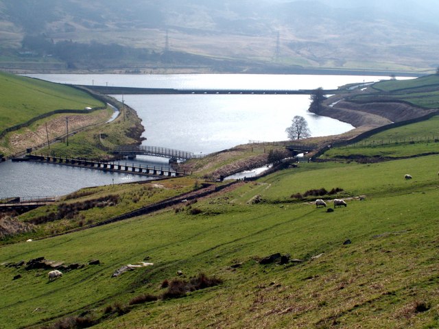
Woodhead Reservoir
![]()
![]() Enjoy a walk alongside this pretty reservoir in the Peak District. A trail runs for several miles along the water with some stunning scenery.
Enjoy a walk alongside this pretty reservoir in the Peak District. A trail runs for several miles along the water with some stunning scenery.
You can start the walk from the large car park just to the south of Torside Reservoir on Woodhead Road. You then follow a shared cycling and walking trail east to Woodhead Reservoir. The trail runs along the southern side of the water with nice views to the surrounding countryside and hills.
To extend the walk pick up the Longdendale Trail and head west to visit Valehouse and Bottoms Reservoir.
Postcode
SK13 1JF - Please note: Postcode may be approximate for some rural locationsWoodhead Reservoir Ordnance Survey Map  - view and print off detailed OS map
Woodhead Reservoir Open Street Map  - view and print off detailed map
Woodhead Reservoir OS Map  - Mobile GPS OS Map with Location tracking
Woodhead Reservoir Open Street Map  - Mobile GPS Map with Location tracking
Pubs/Cafes
If you head west towards Tintwistle you could visit the noteworthy Bull's Head for some post walk refreshments. The 16th century pub does very good food and has a nice cosy fire for winter days. You can easily find the pub in the village at a postcode of SK13 1JY for your sat navs. It's also very dog friendly if you have your canine friend with you.
Further Information and Other Local Ideas
There's another car park slightly closer to the reservoir at Crowden on the northern side. You could start the walk from here if you prefer and cross to the southern side on the bridge. The Crowden Black Hill Walk also starts here and climbs to the highest point in the historic county of Cheshire.
For more walking ideas in the area see the Peak District Walks page.
The Trans Pennine Trail heads north east from the site. You could follow it up to the nearby Winscar Reservoir to extend the walk.
At the eastern side of the reservoir there's another car park where you can start the Middle Black Clough Waterfall Walk. The area is a bit of a hidden gem with walks along the River Etherow to some beautiful waterfalls and wonderful rock formations.
For more walking ideas in the area see the Peak District Walks page.
Cycle Routes and Walking Routes Nearby
Photos
Woodhead Reservoir. From the Northern Horse Route, the A628 Woodhead Road can be seen left middle of photo.
The start of the Woodhead Reservoir The River Etherow can be seen in the bottom left hand quarter, along with the weirs and finally the reservoir. The pic was taken from the Northern Horse Route.
Spillway and pool below the reservoir. Weeks of wet weather has left the reservoirs in the Longdendale valley full to bursting point. The brown water is a result of all rain passing through the peat which makes up the local soil.


