Wye Downs and Crundale Downs Circular Walk
![]()
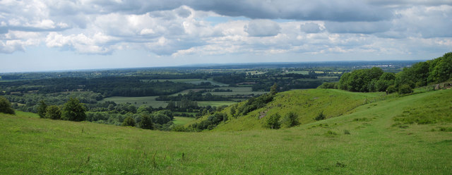
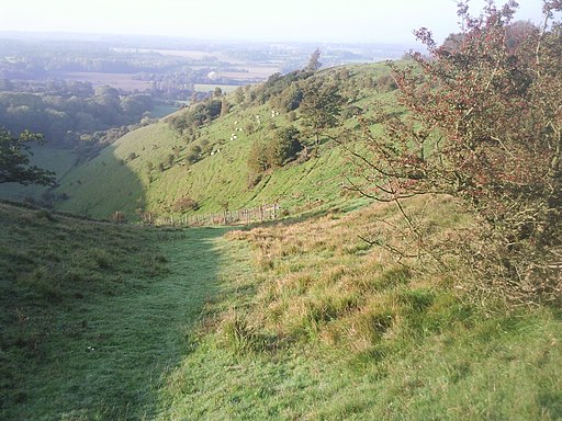
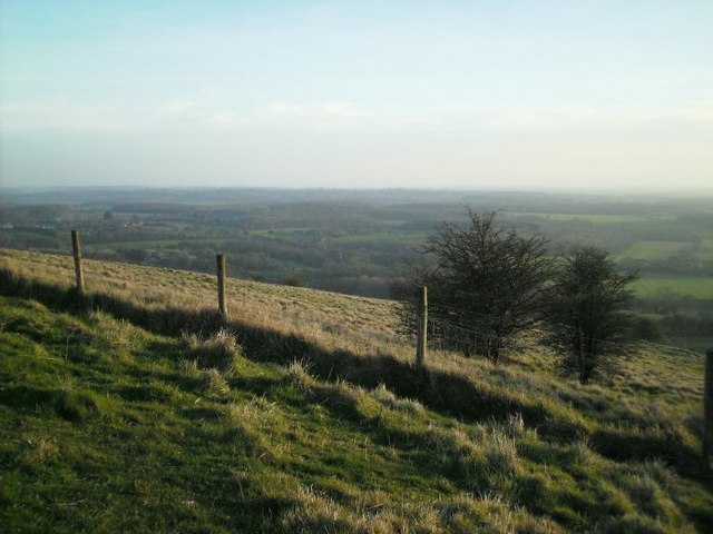
![]() Explore this lovely area of chalk downland and woodland near Wye in Kent. Wye Downs is a nature reserve with several dramatic coombes formed in the ice age. This includes the Devils Kneading Trough, a steep-sided valley with views of Romney Marsh, the Weald and the English Channel. The area is also home to interesting flora and fauna including several species of rare orchid.
Explore this lovely area of chalk downland and woodland near Wye in Kent. Wye Downs is a nature reserve with several dramatic coombes formed in the ice age. This includes the Devils Kneading Trough, a steep-sided valley with views of Romney Marsh, the Weald and the English Channel. The area is also home to interesting flora and fauna including several species of rare orchid.
This circular walk starts at the Wye Downs car park off Coldharbour Lane. From here you can pick up the North Downs Way and other footpaths to explore the reserve. The paths first head north to the Wye Crown. This hill figure was carved in the chalk by students in 1902 to commemorate the coronation of Edward VII. The route then heads north to explore Crundale Downs before heading south to explore the woodland of Pickersdane Scrubs around Broad Downs.
If you prefer you could visit the reserve by following the North Downs Way from the village of Wye. The village is very pretty and well worth exploring. It was voted the third best place to live in the UK in an annual broadsheet's review in 2013. See our Wye Crown Walk for details of how to reach the Downs from the village.
You can virtually explore Wye Downs using the google street view link below!
Postcode
TN25 5HE - Please note: Postcode may be approximate for some rural locationsWye Downs Ordnance Survey Map  - view and print off detailed OS map
Wye Downs Open Street Map  - view and print off detailed map
*New* - Walks and Cycle Routes Near Me Map - Waymarked Routes and Mountain Bike Trails>>
Wye Downs OS Map  - Mobile GPS OS Map with Location tracking
Wye Downs Open Street Map  - Mobile GPS Map with Location tracking
Explore the Area with Google Street View 
Pubs/Cafes
In Wye village you can enjoy some post walk refreshments at The Kings Head. The old Victorian coaching inn has a good menu and also provides fine accommodation if you need to stay over. You can find the inn on Church Street at a postcode of TN25 5BN for your sat navs.
Dog Walking
The downs are a great place for a bracing dog walk and the Kings Head mentioned above is also dog friendly. Your canine friend can enjoy a freshly baked doggy biscuit and even a bottle of doggy beer!
Further Information and Other Local Ideas
Our Ashford Walk starts from the nearby town where there is an international train station. It then follows the River Stour and the North Downs Way up onto the Downs from the town. It's about a 9 mile walk with the option of getting the train back from Wye Station. The fine old stately home at Eastwell Park and the lovely sculpture trail at King's Wood are also located just north of the town.
Cycle Routes and Walking Routes Nearby
Photos
Wye Downs is a National Nature Reserve north-east of Ashford in Kent. It is part of Wye and Crundale Downs Site of Special Scientific Interest.
Wye Downs. Managing species rich grassland with cattle above the Devil's Kneading Trough on Broad Down in the Wye Downs National Nature Reserve. The reserve was declared for its downland grassland which is renowned for its assemblage of many species of orchids in the spring. The cattle are English White, a traditional and rare breed and are owned by Wye Community Farm.
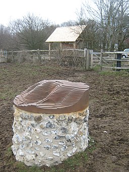
Sculpture and Information Board for the Wye Downs Nature Trail. The information board is near the Pickersdane Scrubs. The sculpture shows the Devil's Kneading Trough. A plaque on the back reads 'Sculpted by rock-shattering frost and scoured by melt-water stream of a distant age, the cherished hills and hollows of the Wye Downs have long occupied a special place in the heart of both traveller and settler. Within each long-trodden track, earth-cast mound and ridge and bank, lie the stories of those who have sought to make a living from these hills. Help us safeguard this rich heritage for future generations, tread carefully in the steps of those who have gone before and enjoy your visit. This sculpture depicts the contour lines of the area of the Devil's Kneading Trough, a dry valley (or 'combe') believed to have been formed 10,000 years ago.'


