Guisborough Forest and Walkway
![]()
![]() This super country park has cycle trails, walking routes, bridleways, a trim trail and an easier sculpture trail. The park includes the Guisborough Walkway which runs along the former trackbed of the Middlesbrough to Whitby railway line. This includes a wetland area with boardwalks, woodlands and grasslands. You can also climb Highcliff Nab for fabulous views of Teeside and the coast. Additionally there's three colour code waymarked trails of varying lengths to try.
This super country park has cycle trails, walking routes, bridleways, a trim trail and an easier sculpture trail. The park includes the Guisborough Walkway which runs along the former trackbed of the Middlesbrough to Whitby railway line. This includes a wetland area with boardwalks, woodlands and grasslands. You can also climb Highcliff Nab for fabulous views of Teeside and the coast. Additionally there's three colour code waymarked trails of varying lengths to try.
The park is also very popular with mountain bikers with a number of super trails to explore. There is an excellent visitor centre with full details of all the trails in the park. You can find the visitor centre at 8 Old Station Cottages, Pinchinthorpe with a postcode of TS14 8HD for your sat navs.
The Cleveland Street Walk and the Cleveland Way walking routes run through or near the park so there is scope for continuing your walk along these trails.
Please click here for more information
Guisborough Forest and Walkway Ordnance Survey Map  - view and print off detailed OS map
Guisborough Forest and Walkway Open Street Map  - view and print off detailed map
Guisborough Forest and Walkway OS Map  - Mobile GPS OS Map with Location tracking
Guisborough Forest and Walkway Open Street Map  - Mobile GPS Map with Location tracking
Pubs/Cafes
There's good facilities at the park with a reasonably priced car park and cafe in the visitor centre. You could also head into Guisborough to the The Anchor Inn. This cosy little pub has a friendly atmosphere and two sparkling log fires for cold winter days. There's also a pleasant conservatory and a pretty garden for the summer months. It's a bit of a hidden gem and well worth investigating if you have some free time after your walk. You can find the pub at 16 Belmangate with a postcode of TS14 7AB.
Dog Walking
The woods are a great place for a dog walk and you will probably see plenty of other owners on your outing.
Further Information and Other Local Ideas
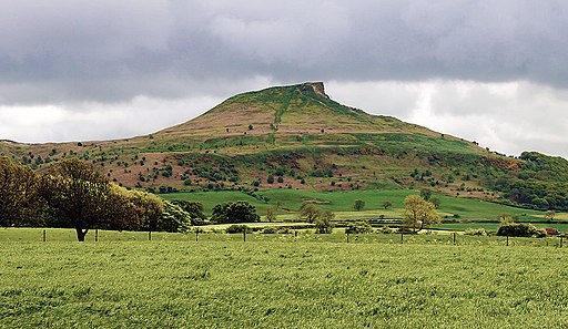
The eastern end of the forest is located close to two of the real highlights of the area. If you head west through Hutton Lowcross Woods you will soon come to the wonderful Roseberry Topping. The iconic hill's summit has a symbolic half-cone shape and jagged cliff, which has been likened to the Matterhorn in Switzerland. The area is run by the National Trust so there is a car park and a good footpath to the top. From here you can enjoy fine views back down to the forest.
Just south from here you will find Captain Cook's Monument which is another important local landmark. There's another good climb to the top where you will find an obelisk 60 ft (18 m) high in memory of the great British explorer. Both of these sites can be reached on our Cleveland Way Circular Walk from Great Ayton. The route starts in the village and uses a section of the waymarked National Trail to take you through the area.
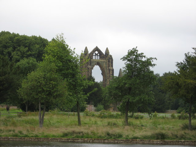
Head north into the town of Guisborough itself and you could pay a visit to Gisborough Priory. The Augustinian priory has a facinating history dating back to the 12th century. You can enjoy a stroll around the atmospheric ruins where there is a distinctive arch, which is a well-known landmark used as a symbol for Guisborough. The site is run by English Heritage and is free to explore. You can find it in the attracive market town at Priory Grounds, Church Street at postcode TS14 6HG.

Cycle Routes and Walking Routes Nearby
Photos
Guisborough Forest and Walkway visitor centre. Excellent and popular use being made of the disused railway at Pinchinthorp.
Trees in the shadow of Guisborough Forest. A lovely October afternoon walk.
As you wander through the forest, you'll notice a diverse mix of native trees such as ancient oak, birch, and Scots pine, whose intertwining canopies create a dappled light effect on the forest floor. In spring, the woodland bursts into life with carpets of bluebells and wild garlic, while ferns unfurl and delicate wildflowers emerge in the clearings, adding a soft vibrancy to the rugged landscape.
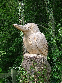
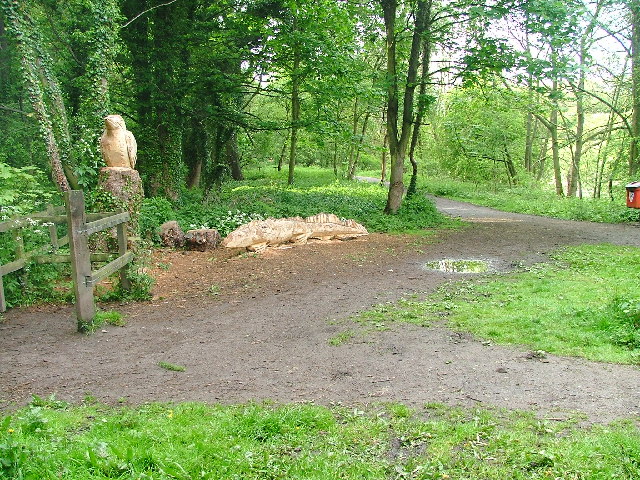
Sculptures on the trail. The rich habitat supports an array of wildlife; birds flit between branches, with species like blue tits, great tits, chaffinches, and woodpeckers calling the forest home, and small mammals such as red squirrels, foxes, and badgers can often be glimpsed among the undergrowth. Insects, including various butterflies and moths, complete the scene, contributing to the overall ecological tapestry of the area. Beyond its natural allure, the walkway itself provides a gentle, meandering path that invites visitors to explore the forest at a leisurely pace, with scenic views at every turn and subtle clues to the region’s past.


