Carding Mill Valley Waterfall Walk
3.1 miles (5 km)
Visit a lovely reservoir and waterfall on this short walk in the Shropshire Hills AONB. The walk starts at the National Trust's Carding Mill Valley visitor centre and car park in Church Stretton.... You begin by following a pretty stream uphill on a good stony path before bearing left on New Pool Hollow to visit the pretty reservoir. You'll pass mill pools and the 2500 year old Bodbury Ring hill fort on the way. The walk then continues uphill to Lightspot Hollow where you will find a waterfall in a beautiful V-shaped valley lined with�bilberry, bracken and heather. You can look out for trout in the pools and stonechats, buzzards and red kites�in the air.
If you'd like to continue your walk you could head to the high point of the Long Mynd at Pole Bank. You could also climb the nearby Caer Caradoc for more fabulous views. The Shropshire Way and the Jack Mytton Way also pass through the area so you could pick these up easily too.
Postcode: SY6 6JG
Pubs and More Info
There's a nice National Trust team room in the valley where you can go for some post walk refreshments. In the winter there's a log fire to warm yourself by. For warmer days you can sit outside on the lovely roof terrace.
From nearby Little Stretton there's the Ashes Hollow Walk which will take you along the Quinny Brook in a stunning V shaped valley.
More
Photos
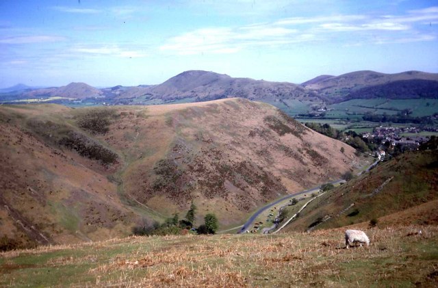
Photo of the valley with Church Stretton to the right and Caer Caradoc Hill on the horizon.

Looking down from Calf Ridge towards Church Stretton and beyond. The town is historically known for its textile industry with the valley being a central location. The�carding mill itself dates from the 18th century and is named after the first stage in making cloth. The three stages being�carding,�spinning�and�weaving. The carding mill was closed and later demolished at the beginning of the 20th century, though the adjacent factory building can still be seen in the valley today. The mill building itself has been converted into flats and a number of other private houses exist near it and the visitor centre, forming a small settlement in the valley.
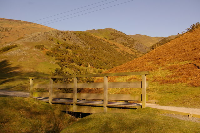
Footbridge in Carding Mill Valley Looking up "The Pike". The area is rich in geological interest, with visible evidence of its ancient volcanic origins.

Descending the Carding Mill Valley. The fauna in Carding Mill Valley includes red kites and buzzards, which are often seen soaring overhead. Smaller birds such as stonechats, skylarks, and meadow pipits can be spotted flitting among the heathland. The valley is also home to mammals such as rabbits, foxes, and occasional badgers. In the waterways, you might see trout or even otters, though the latter are more elusive.

Carding Mill Valley Reservoir

Ford. The valley’s streams and wetland areas support species such as mosses, sedges, and rushes. These damp habitats attract dragonflies and damselflies, particularly during warmer months. Woodland areas on the lower slopes are populated with trees such as rowan, birch, and oak, providing shelter for a variety of birds and mammals.

Heather in the valley. The valley’s heathland habitat is dominated by heather and bilberry, which provide vibrant purple and green hues in late summer. Gorse and bracken are also widespread, adding texture and supporting various insect species. In spring and summer, wildflowers such as harebells, tormentil, and heath bedstraw can be found, creating bursts of colour across the landscape.

The stream and path wind up Light Spout Hollow valley This area is a popular spot for families and walkers and is under the stewardship of the National Trust. The line of the man made dam shows evidence of a happy day's 'work'.
 Ordnance Survey Map
 OpenStreetMap


