Long Mynd Walk
![]()
![]() This circular walk takes you to Pole Bank, the highest point on the Long Mynd in the Shropshire Hills AONB. Much of this beautiful area is owned and managed by the National Trust so there are good footpaths to follow to the 516m (1,693 ft) summit.
This circular walk takes you to Pole Bank, the highest point on the Long Mynd in the Shropshire Hills AONB. Much of this beautiful area is owned and managed by the National Trust so there are good footpaths to follow to the 516m (1,693 ft) summit.
The walk starts at the National Trust's Carding Mill Valley visitor centre and car park in Church Stretton. You begin by following a pretty stream uphill on a good stony path. You continue along Mott's Road passing Calf Ridge and Lightspot Hollow where there is the option to take a short detour to Lightspot Waterfall. At the top of the hill you head west along the ancient Portway, passing a Neolithic monument which was converted to a shooting box during the Victorian period. You soon come to the summit at Pole Bank where there are magnificent views of the Brecon Beacons, the Cambrian and Berwyn Mountains, Snowdonia and the Malverns. After taking in the views you descend passing the spring at Boiling Well and continuing through Townbrook Valley with its pretty brook and Victorian reservoir. A short woodland section then takes you to the finish point at the car park.
The walk makes use of the Shropshire Way and the Jack Mytton Way so there is the option of continuing your walk along these long distance footpaths. You could also climb the nearby Caer Caradoc for more fabulous views. If you're looking for a shorter less strenuous walk you could visit the reservoir and waterfall on the Carding Mill Valley walk.
Long Mynd Ordnance Survey Map  - view and print off detailed OS map
Long Mynd Open Street Map  - view and print off detailed map
Long Mynd OS Map  - Mobile GPS OS Map with Location tracking
Long Mynd Open Street Map  - Mobile GPS Map with Location tracking
Pubs/Cafes
Back in Church Stretton there are several nice pubs and cafes for refreshment after your exercise. Of particular note is the Kings Arms on the High Street. It dates back to 1593 and is one of the oldest pubs in the area. It has a cosy interior with original beams and a log burner to warm yourself by on colder days. Outside there's a patio and a pretty garden area if the sun is shining. You can find the old pub on the High Street with a postcode of SY6 6BY for your sat navs.
The worthy village of Ratlinghope is located just west of the Pole Bank summit. It's a pretty place located on both the River East Onny and the Darnford Brook. You could explore the village, enjoy a waymarked circular climb to Adstone Hill and then head to The Bridges Pub which is in a lovely riverside spot. They serve homegrown, locally sourced food and drink. It's great in fine weather with a garden area in the front overlooking the River East Onny as well as a secluded rear garden sitting alongside the Darnford Brook. You can find them at postcode SY5 0ST for you sat navs.
Dog Walking
The area is great for fit dogs as there is some climbing involved. There's also lots of nice woodland trails on the hills. The Kings Arms pub mentioned above is also dog friendly.
Further Information and Other Local Ideas
From nearby Little Stretton there's the Ashes Hollow Walk which will take you along the Quinny Brook in a stunning V shaped valley. The valley is an alternative route for climbing to the Pole Bank summit.
Cycle Routes and Walking Routes Nearby
Photos
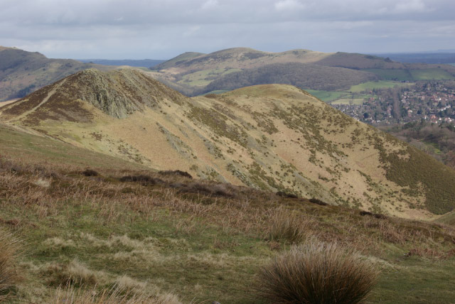
Long Mynd - meaning 'long mountain'. Viewed from close to the Church Stretton - Asterton Road; the hill in the middle distance is Burway Hill. The Long Mynd is approximately 7 miles (11 km) long and characterised by steep valleys and steep escarpments.
A small herd of ponies graze the track near Round Hill, looking well cared for. Other wildlife you can see in the area include Tree pipit and red grouse. In the warmer months you can see lots of pretty butterflies fluttering around the wildflowers and the heather. Species include grayling, small heaths, green-veined whites and dark-green fritillaries.
The main route of the Shropshire Way near The Shooting Box has been closed for restoration, and this view is from the southerly diversion, across the upper end of Light Spout Hollow, with Hope Bowdler Hill in the distance.


