Hartlebury Common
![]()
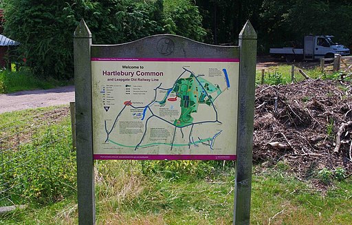
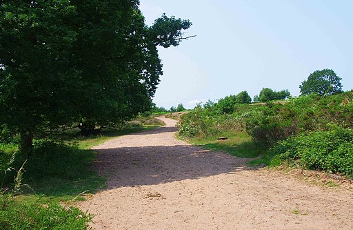
![]() Hartlebury Common and Hillditch Coppice cover 229 acres of lowland heath in Stourport-on-Severn. The area is criss crossed with a number of lovely waymarked walking paths where you can see many varieties of wild plants and insects, especially butterflies and moths. There are a number of habitats to enjoy including woodlands, heather covered hills, an acid bog, a pool and brook.
Hartlebury Common and Hillditch Coppice cover 229 acres of lowland heath in Stourport-on-Severn. The area is criss crossed with a number of lovely waymarked walking paths where you can see many varieties of wild plants and insects, especially butterflies and moths. There are a number of habitats to enjoy including woodlands, heather covered hills, an acid bog, a pool and brook.
Hartlebury Castle is located right next to the common so you could easily visit this interesting Grade I listed building on your walk. It was originally built in the mid-13th century as a fortified manor house. It now houses the Worcestershire County Museum where you can find out about the history of the area. Inside there are period room displays including a schoolroom, a nursery and a scullery, while outside in the grounds there is a cider mill and transport display with a fire engine, hansom cab, bicycles, carts and Gypsy caravans.
If you'd like to continue your walk then you could easily pick up the Severn Way and enjoy some lovely riverside walking. Our Stourport Circular Walk also visits the common, the River Severn and the Staffordshire and Worcestershire Canal.
Hartlebury Common Ordnance Survey Map  - view and print off detailed OS map
Hartlebury Common Open Street Map  - view and print off detailed map
Hartlebury Common OS Map  - Mobile GPS OS Map with Location tracking
Hartlebury Common Open Street Map  - Mobile GPS Map with Location tracking
Pubs/Cafes
The Bay Horse pub is located right next to the common and a fine place for some post walk refreshments. They serve good quality food with an attractive interior including a dining area with beamed ceilings. Outside there's a nice garden area for warmer days. You can find them at postcode DY13 9JA for your sat navs.
Dog Walking
The wide tracks on the common are ideal for a dog walk. You'll probably meet other owners on your visit. The Bay Horse mentioned above is also dog friendly.
Cycle Routes and Walking Routes Nearby
Photos
The edge of Hartlebury Common. Once you pass through the space ahead, where a gate once hung, you have left the common, but there is a public footpath over the track on the other side of the hedge


