Severn Way
![]()
![]() Follow the River Severn from its source at Plynlimon in Powys, to Bristol, the mouth of the river. You start the walk at Plynlimon in upland Mid Wales, before descending into Llanidloes, Newtown, Powys, and Welshpool. The route then follows the towpath of the Montgomery Canal passing The Wrekin and continuing on through Shrewsbury, the Severn Gorge, and the historic town of Ironbridge. You then cross into Worcestershire passing Bewdley, Stourport-on-Severn, Worcester and Upton-upon-Severn in the Malvern Hills. The next section passes through Gloucestershire and includes a section along the Gloucester and Sharpness Canal which takes you past the fascinating abandoned ships at Purton Hulks. You'll also visit Tewkesbury, Gloucester, the 12th century Berkeley Castle before heading to the Severn Estuary and the mouth of the Severn near Oldbury on Severn.
Follow the River Severn from its source at Plynlimon in Powys, to Bristol, the mouth of the river. You start the walk at Plynlimon in upland Mid Wales, before descending into Llanidloes, Newtown, Powys, and Welshpool. The route then follows the towpath of the Montgomery Canal passing The Wrekin and continuing on through Shrewsbury, the Severn Gorge, and the historic town of Ironbridge. You then cross into Worcestershire passing Bewdley, Stourport-on-Severn, Worcester and Upton-upon-Severn in the Malvern Hills. The next section passes through Gloucestershire and includes a section along the Gloucester and Sharpness Canal which takes you past the fascinating abandoned ships at Purton Hulks. You'll also visit Tewkesbury, Gloucester, the 12th century Berkeley Castle before heading to the Severn Estuary and the mouth of the Severn near Oldbury on Severn.
The final section takes you from Severn Beach to Bristol via Lawrence Weston, Shirehampton and through the Avon Gorge.
The route is well waymarked with a blue and white logo.
Severn Way Ordnance Survey Map  - view and print off detailed OS map
Severn Way Open Street Map  - view and print off detailed map
Severn Way OS Map  - Mobile GPS OS Map with Location tracking
Severn Way Open Street Map  - Mobile GPS Map with Location tracking
Pubs/Cafes
In Llanidloes one of the highlights is the historic Angel Inn. The Timber framed former Coaching Inn was built way back in 1748. The Pub has a wealth of character with many original features including Oak beams in the Bar and Lounge. There's a very good menu and some picnic tables outdoors for warmer days. It is located close to the center of Llanidloes on the High Street with a postcode of SY18 6BY for your sat navs.
In Aust next the Severn bridge there's The Boars Head to consider. The 17th century country inn has a fine interior with cosy fires for colder days. Outside there's a lovely garden area if the weather is fine. You can find them at a postcode of BS35 4AX for your sat navs. The inn is also very dog friendly with water bowls and treats readily available for your canine friend.
In the little village of Oldbury on Severn there's the historic Anchor Inn. The pub has a charming olde worlde interior with beams, stones, cushioned window seats, winged seats against the wall and a cosy fire for colder days. There's also some lovely oil paintings by local artists. Outside there's a lovely garden area for warmer weather. You can find them on Church Lane at a postcode of BS35 1QA for your sat navs. The village is also very pleasant to stroll around. You could head up to the old church which sits on a little hill above the village. The church provides a peaceful viewpoint over the area from its elevated position.
Near Brignorth you will pass the pretty riverside village of Hampton Loade. Here you could pay a visit to The Unicorn Inn which is located in a lovely spot on the banks of the river. It dates back to the 17th century and serves a fine Sunday lunch. There's also a decent Caravan and Campsite with plots for tents, caravans, campervans and motorhomes with electrical hookups. The village also includes a railway station on the Severn Valley Railway.
Further Information and Other Local Ideas
Just a mile south of the Iron Bridge you could take a detour from the route to visit the historic Benthall Hall. This National Trust owned hall dates from the 16th century and includes some beautiful gardens. You can tour the fine house and learn all about the interesting family history which dates back to the doomsday.
Near the end of the walk around the Severn Estuary you will find a huge variety of interesting wildlife. Over 250 species of bird documented have been documented in the area. Look out for rarer species including Balearic shearwaters, skua, peregrine falcons and seals as you make your way along the sea wall near Severn Beach.
Cycle Routes and Walking Routes Nearby
Photos
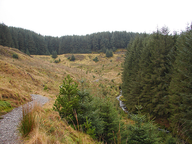
The Severn Way. An open area before the final section within the forestry in Hafren. A forestry road can be seen running across the top section of the view.
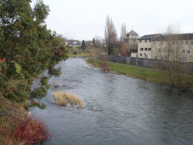
River Severn, Newtown Viewed from the northern end of Long Bridge. The tower of the Church of Saint Mary, abandoned for worship in 1856 because it was too small and was frequently subject to flooding, stands on what at this point is the south bank of the river. Beside it are buildings associated with the Elephant and Castle Hotel. The flood defence wall was constructed after serious flooding in the 1960s. It is not unusual for the water to rise well above the footpath on the river side of this wall.
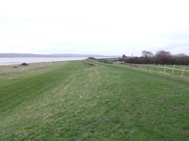
Looking along the Binn Wall at Severn Beach. Looking towards the Severn Bridge, whilst standing on the lower levels of the Binn Wall defences. The original Binn Wall dates from 1815, although this version was completed in 1998. The sea wall around here is a popular place for walkers with fine views over the river into Wales.
Near Oldbury on Severn. The Severn estuary begins to narrow here, with rocks off the southern bank. Chapel House with its lighthouse is just visible. The hills opposite are those rising north of Lydney in the Forest of Dean.
Rhine Mouth near Berkeley. Looking north-west from beside the sluice (see other photo for this square). The rhine (a local name for drainage streams; pronounced 'reen') enters the River Severn at low tide. The Severn fills 3/4 of this grid square. You could also take a detour around here to visit the historic Berkeley Castle which dates from the 11th century.
Elevation Profile


