Whinfell Forest Walks
![]()
![]() This walk visits the Cliburn Moss Nature Reserve before following woodland trails into the adjacent Whinfell Forest.
This walk visits the Cliburn Moss Nature Reserve before following woodland trails into the adjacent Whinfell Forest.
Much of the area is taken up by the Center Parcs but there are public footpaths through the forest as well. You can park at the Cliburn Moss car park and explore the reserve first. It has some nice waymarked footpaths taking you to fen, bog, heath and woods. Look out for wildlife including red squirrels, blackcaps and willow warblers. After exploring the reserve you can head north and skirt around the edge of the holiday village in Whinfell Forest.
The woods are located a few miles south east of Penrith. You can follow National Cycle Network Route 71 from Penrith to the woods.
To extend your walking in the area you could visit the National Trust owned Acorn Bank. Here you can explore stunning gardens and visit the restored 19th century watermill. Also nearby is
Lowther Castle with its 130 acres of parkland and the splendid Lakeland Bird of Prey Centre.
Whinfell Forest Ordnance Survey Map  - view and print off detailed OS map
Whinfell Forest Open Street Map  - view and print off detailed map
Whinfell Forest OS Map  - Mobile GPS OS Map with Location tracking
Whinfell Forest Open Street Map  - Mobile GPS Map with Location tracking
Pubs/Cafes
In the Center Parcs section of the forest there's several places for refreshments including a Cafe Rouge and a Pancake House. If you head east to the nearby Acorn Bank there's a lovely National Trust tea room. You can access the tea-room without paying to visit the house, gardens and watermill – just call at reception to let them know.
Dog Walking
The public woodland trails in the forest make for a good dog walk. The NT tea room mentioned above is also dog friendly in the courtyard.
Further Information and Other Local Ideas
A few miles to the north east of Penrith you'll find one of the area's top attractions at Hutton in the Forest. The 17th century country house is surrounded by some beautiful landscaped gardens with herbaceous plants, ponds with cascades and some fine topiary. There's also a lovely woodland walk with some fine specimen trees and lots of wildlife.
For more walking ideas in the area see the Lake District Walks and the Cumbria Walks pages.
Cycle Routes and Walking Routes Nearby
Photos
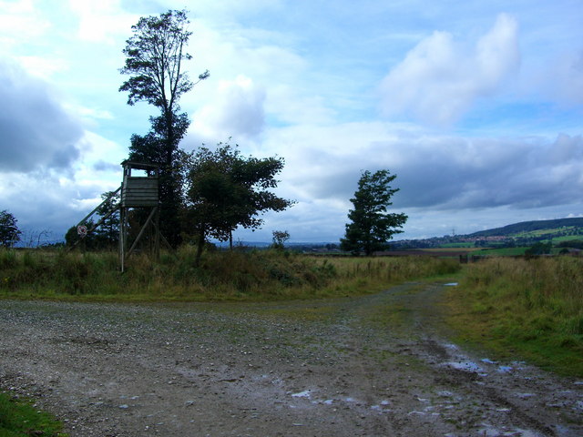
Whinfell Forest. A Nature trail in the southeast corner of the Center Parcs Holiday Village. If you have young children this place makes holidaying easy.


