Drakes Trail - Tavistock to Yelverton and Plymouth
![]()
![]() This 22 mile cycle or walk runs from Tavistock to the coast at Plymouth, along National Cycle Route 27. Much of the route is traffic free with visits to local parks and woods to enjoy on the way. The trail is named after the explorer Sir Francis Drake who was born in Tavistock and has a statue in Plymouth. The route also passes along Drake's Leat a watercourse constructed in the late 16th century to tap the River Meavy which supplied Plymouth with its water.
This 22 mile cycle or walk runs from Tavistock to the coast at Plymouth, along National Cycle Route 27. Much of the route is traffic free with visits to local parks and woods to enjoy on the way. The trail is named after the explorer Sir Francis Drake who was born in Tavistock and has a statue in Plymouth. The route also passes along Drake's Leat a watercourse constructed in the late 16th century to tap the River Meavy which supplied Plymouth with its water.
The route starts in Tavistock, next to the river Tavy. Near here you pick up a traffic free section running along a disused railway line. It will take you south west to Launceston New Road Bridge before heading south east towards the Tavistock Canal and Brook Mill on the river. You continue south to Rixhill before crossing the River Walkham on the Grenofen Bridge. You continue south through Sticklepath Wood and Harrowbear to Yelverton. Here you could stop off to the visit the beautiful Yelverton Garden House.
The next stage takes you to Clearbrook where you pick up the Plym Valley Trail. This off road section follows the old Plym Valley railway from Clearbrook to the splendid Saltram Park. This section passes Bickleigh Vale and Great Shaugh Wood with views of the River Plym as you go. You'll also pass Cann Woods on your left as you make your way towards the coast. In Saltram park National Cycle Network Route 27 runs along a splendid traffic free trail through Saltram Wood and along the river.
After passing the park you cross the river on Laira Bridge and head through Princes Rock and St Jude's before finishing near the harbour in Plymouth.
Please click here for more information
Drakes Trail Ordnance Survey Map  - view and print off detailed OS map
Drakes Trail Open Street Map  - view and print off detailed map
*New* - Walks and Cycle Routes Near Me Map - Waymarked Routes and Mountain Bike Trails>>
Drakes Trail OS Map  - Mobile GPS OS Map with Location tracking
Drakes Trail Open Street Map  - Mobile GPS Map with Location tracking
Pubs/Cafes
On the route you could stop in Horrabridge for some rest and refreshment at the Leaping Salmon. The historic inn has a charming interior with inglenook fireplaces, stone walls, beamed ceilings, and lots of natural light. Outside there's a lovely tiered garden area with views over the village. They serve good quality food and also have a car park. You can find them at postcode PL20 7TP for your sat navs. The pub is dog friendly.
The village is also worth exploring with its ancient packhorse bridge over the River Walkham.
Further Information and Other Local Ideas
Near Yelverton there's the popular Cadover Bridge to Dewerstone Rocks Walk to try. The circular trail explores the River Plym and the adjacent Dewerstone Woods on Dartmoor. You can also visit the delightful village of Shaugh Prior in this National Trust owned area. The village has a fine local pub with a particularly lovely garden area complete with goats and ponies.
In Tavistock you pass the Granite Way. The trail explores the Dartmoor National Park on a disused railway line.
Cycle Routes and Walking Routes Nearby
Photos
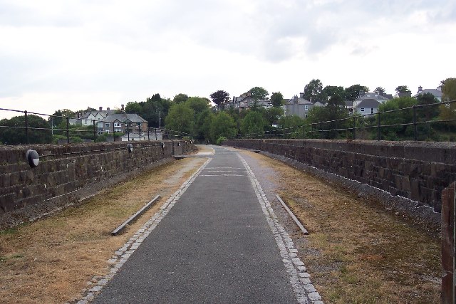
Tavistock Viaduct. Tavistock Viaduct was immediately south-west of the site of the Southern Railway station at Tavistock (behind the photographer).
This is part of a the cycleway being built along the northern edge of Roborough Down to connect Yelverton and Horrabridge.


