Great Northern Greenway
![]()
![]() This is the first open section of the Great Northern Greenway, running between Derby City and Breadsall. When complete it will run from Derby City to Ilkeston.
This is the first open section of the Great Northern Greenway, running between Derby City and Breadsall. When complete it will run from Derby City to Ilkeston.
The shared cycling and walking route runs along National Cycle Network Route 672 and the trackbed of the former Great Northern Railway which closed in the 1960s. The easy surfaced path is ideal for a safe cycle or walk.
The route starts on Mansfield road just to the east of the Meteor Shopping Centre. You can then follow the trail north east towards Morley.
At the southern end the greenway links up with National Cycle Route 66. At the northern you can pick up the Midshires Way and the Centenary Way around Morley.
The start point for the route is also very close to Darley Abbey Park. The historic parkland includes nice river trails and views of the ruins of the ancient Augustinian Abbey.
Postcode
DE21 5LQ - Please note: Postcode may be approximate for some rural locationsGreat Northern Greenway Ordnance Survey Map  - view and print off detailed OS map
Great Northern Greenway Open Street Map  - view and print off detailed map
Great Northern Greenway OS Map  - Mobile GPS OS Map with Location tracking
Great Northern Greenway Open Street Map  - Mobile GPS Map with Location tracking
Cycle Routes and Walking Routes Nearby
Photos
Derby Racecourse Station, on the former Great Northern Railway, had a loading dock and paddock for visiting race horses. The pub, nearby, is still called The Paddock but the railway and race course are long gone. The former track bed is now part of the Great Northern Greenway.
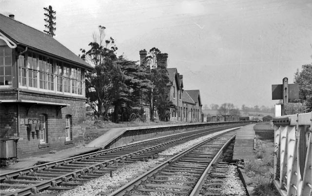
A view of the functioning Breadsall rail station in 1961. View eastward, towards Nottingham etc.; ex-GNR Grantham - Nottingham - Derby seconadry main line. Station closed to passengers 6/4/53, to goods 3/12/62. The passenger service Derby (Friargate) - Nottingham (Victoria) ceased 7/9/64, but probably the line was not closed completely until 9/67. The station-'master' at this time was female.


