National Cycle Route 55
![]()
![]() This signed Sustrans Cycle Route runs from Ironbridge to Preston via Cheshire and Greater Manchester.
This signed Sustrans Cycle Route runs from Ironbridge to Preston via Cheshire and Greater Manchester.
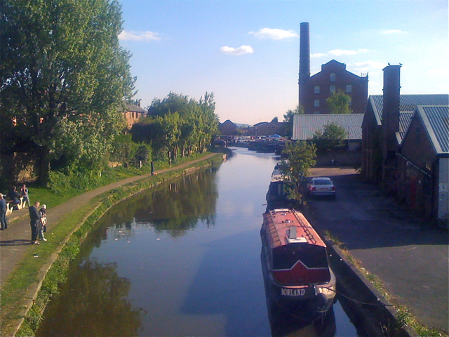
Highlights on the route include the long traffic free sections along dismantled railway lines on the Biddulph Valley Way at Congleton and the Middlewood Way between Macclesfield and Marple. You'll also enjoy easy waterside cycling along sections of the Macclesfield Canal and the Leeds and Liverpool Canal.
Please note, as of time of writing the route is almost, but not quite fully complete. The section between Stafford and Stoke-on-Trent follows part of National Cycle Route 5.
There's also a section around Stockport and Chorlton which uses National Cycle Route 62.
Between Tyldesley and Amberswood Lake is the proposed future section so this may need some walking/or a small detour.
Cycle Routes on National Cycle Route 55
- Biddulph Valley Way - This circular route starts in Congleton and first follows the Biddulph Valley Way (a traffic free disused railway path) before turning round to return to Congleton
- Macclesfield to Marple - Middlewood Way - Follow the Middlewood Way - a lovely off road cycle and walking path running from Macclesfield to Marple and passing by the Macclesfield Canal.
- Stafford to Market Drayton - This route follows National Cycle route 55 and local signed cycle routes from Stafford to Market Drayton via Newport.
The route starts near Stafford centre on the National Cycle route 55 and follows a dismantled railway before a series of quiet signed country roads takes you through Newport and on to Market Drayton in Shropshire - Buxton to Marple - Follow NCN route 55 and route 68 from Buxton in the Peak District to the lovely town of Marple in Cheshire.
- Shrewsbury to Telford - Follow National Cycle routes 81, 45 and 55 through Shropshire on this pleasant ride
National Cycle Route 55 Ordnance Survey Map  - view and print off detailed OS map
National Cycle Route 55 Open Street Map  - view and print off detailed map
National Cycle Route 55 OS Map  - Mobile GPS OS Map with Location tracking
National Cycle Route 55 Open Street Map  - Mobile GPS Map with Location tracking
Further Information and Other Local Ideas
In the Macclesfield area of Cheshire you can link with the Cheshire Cycleway. The popular circular ride explores the best parts of the county on a series of quiet country lanes and off road paths.
Photos
View of the Biddulph Valley Way. The trail follows the old railway line that runs from the former colliery at Chatterly Whitfield to Congleton. It is a very popular route for walkers, cyclists and horse riders. It is maintained by Staffordshire County Council and is part of Sustrans cycle route 55.
Sneyd Green. The route proceeds steeply upwards through public open space fields at the rear of Noblett Road, Sneyd Green in the direction of Birches Head.
Holden Lane Working Men's Club. Route 55 heading northeast to the rear of Noblett Rd Sneyd Green passes to the rear of Holden Lane Working Men's Club to join onto Ralph Drive at a cycle gate.


