Stithians Lake Walk
![]()
![]() Enjoy waterside cycling and walking in this country park near Redruth in Cornwall. The route starts at the car park on the eastern side of the reservoir and runs right alongside the lake for most of the way. There is a short section along country lanes to Penmarth at around the half way point. For walkers the path runs around the whole of the lake but the cycle path runs for a shorter distance to the dam at the north end of the lake.
Enjoy waterside cycling and walking in this country park near Redruth in Cornwall. The route starts at the car park on the eastern side of the reservoir and runs right alongside the lake for most of the way. There is a short section along country lanes to Penmarth at around the half way point. For walkers the path runs around the whole of the lake but the cycle path runs for a shorter distance to the dam at the north end of the lake.
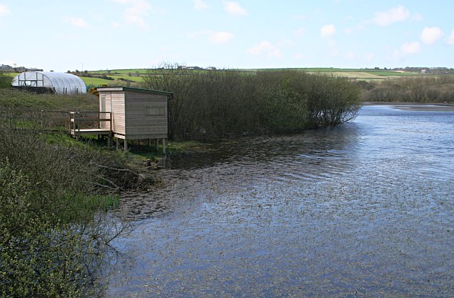
The park is great for bird watching with a number of hides to use. There's also a splendid cafe and a watersports centre.
To extend your walking in the area you can visit the lovely Kennall Vale Nature Reserve. Here you'll find nice woodland walking trails along the River Kennal and the ruins of Kennall Vale Gunpowder Works.
Postcode
TR16 6NW - Please note: Postcode may be approximate for some rural locationsPlease click here for more information
Stithians Lake Ordnance Survey Map  - view and print off detailed OS map
Stithians Lake Open Street Map  - view and print off detailed map
Stithians Lake OS Map  - Mobile GPS OS Map with Location tracking
Stithians Lake Open Street Map  - Mobile GPS Map with Location tracking
Pubs/Cafes
Café Lake Central is right next to the lake and serves great pizzas. On warmer days you can sit out on the decking area and enjoy views of the lake with your meal.
Dog Walking
The lakeside path is a great place for a dog walk and they are allowed of leads but under control.
Further Information and Other Local Ideas
The lake is located to the south west of Truro. There's some nice trails along the Truro River to Boscawen Park and the pretty estuary at Malpas here. Truro is also notable as Cornwall's only city and includes a wonderful cathedral which is well worth a visit.
The circular Great Flat Lode Trail can be picked up a couple of miles north of the lake. It's a shared cycling and walking trail which takes you to some of Cornwall's old mines and the historic hill top site of Carn Brea.
Just a few miles to the east of Redruth there's some great walking and mountain bike trails to be found at the Poldice Valley. The area has a wonderful moon like appearance with the historic Poldice Mine buildings adding to the atmospheric landscape.
For more walking ideas in the area see the Cornwall Walks page.
Cycle Routes and Walking Routes Nearby
Photos
This body of water is referred to on local signs as a lake, which gives the impression it is a natural feature. It is in fact a reservoir and at the time of visiting, very full and ready to supply the extra demands for water in the Summer.
The photograph was taken from one of the two points on Stithians Lake where roads cross arms of the reservoir on embankments. The photograph looks out to the northeast. The bright yellow strip is an adjacent daffodil field.


