Alderley Edge Circular Walk
![]()
![]() This lovely circular walk explores the beautiful National Trust owned area of Alderley Edge. Starting at Alderley Edge train station you climb to a sandstone escarpment, where there are fabulous over the Cheshire Plain to the Peak District. You return through a delightful wooded area, passing a waterfall, before arriving back at Alderley Edge train station.
This lovely circular walk explores the beautiful National Trust owned area of Alderley Edge. Starting at Alderley Edge train station you climb to a sandstone escarpment, where there are fabulous over the Cheshire Plain to the Peak District. You return through a delightful wooded area, passing a waterfall, before arriving back at Alderley Edge train station.
The National Trust have also devised a number of other walking trails which you can pick up from the Wizard Tea-Room. These include the Miners Ramble which explores the age-old mining history of the Edge. The Wizard Trail also starts from the edge and will take you to the the Wizard's well, the 15th century Alderley mill and National Trust owned Hare Hill. You can follow a permissive path south to Hare Hill to extend the walk.
It's about a 1.5 mile walk south east from the edge and includes beautiful gardens with 70 varieties of rhododendron, azaleas, hollies, and hostas. The centrepiece is a walled garden containing a pergola and wire sculptures.
Please click here for more information
Alderley Edge Ordnance Survey Map  - view and print off detailed OS map
Alderley Edge Open Street Map  - view and print off detailed map
*New* - Walks and Cycle Routes Near Me Map - Waymarked Routes and Mountain Bike Trails>>
Alderley Edge OS Map  - Mobile GPS OS Map with Location tracking
Alderley Edge Open Street Map  - Mobile GPS Map with Location tracking
Pubs/Cafes
The Wizard Tea Room is a fine place for refreshments after your walk. The family run cafe is housed in a beautiful National Trust building. They serve tea, coffee & homemade food from locally sourced suppliers. There is also a nice outdoor seating area if the weather is fine. You can find them at Macclesfield Rd, Nether Alderley with a postcode of SK10 4UB for your sat navs.
Dog Walking
The woodland and country trails at the site are ideal for dog walking, so you'll probably bump into several other owners on your visit. The tea rooms mentioned above are also dog friendly inside and out.
Further Information and Other Local Ideas
The village has a train station located a short walk from the site. You can catch the train here direct from Manchester Piccadilly via Stockport.
Head north from the village and you can pick up the Wilmslow Walk. This visits the popular Carrs Park before following the River Bollin to the nearby Styal Country Park and Woods.
A few miles west you will find the worthy village of Mobberley. This pretty little settlement includes a 13th century church and several splendid village pubs.
To the east the worthy village of Prestbury is well worth a visit.
The village includes several listed timber framed buildings, a 17th century pub, a picturesque churchyard and views of the River Bollin. Look out for famous faces too as it is one of the most desirable places to live in the north with many celebrities and footballers purchasing expensive properties in the area.
Near Prestbury there's the Grade II listed Mottram Hall to explore. The estate includes 270 acres of beautiful landscaped gardens surrounding a fine 18th century hall which now operates as a hotel.
For more walking ideas in the area see the Cheshire Walks page.
Cycle Routes and Walking Routes Nearby
Photos
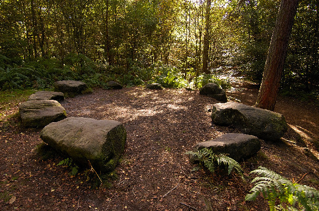
The Edge Alderley Edge - The Edge has a long history for mining - lots of mine shafts, and tunnels in the area.
Woodland on Alderley Edge. The hill here was worked for copper, there are many pits and mounds from the mining days.
Elevation Profile


