The George Alstonefield Walks
![]()
![]() This walk takes you from the Staffordshire village of Astonefield to Dovedale in the Peak District.
This walk takes you from the Staffordshire village of Astonefield to Dovedale in the Peak District.
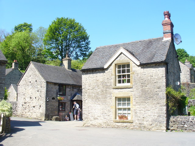
The walk starts from the popular George Inn Pub on Church Lane in the village centre. The noteworthy inn dates from the 18th century and is situated in a lovely spot on the village green. It's very walker friendly and has a nice outdoor seating area to relax in. From the pub you can follow Church Lane and Millway Lane south east to a footpath which will take you to nearby Milldale. The little hamlet has some pretty stone cottages and is situated next to the River Dove. Here you can pick up footpaths heading south along the river through the beautiful Dovedale.
On the path there's attractive woodland, interesting vegetation and interesting geological rock formations. The path leads to the Dovedale Stepping Stone which is a hugely popular beauty spot. The stones were first set down in the 19th century for Victorian tourists to cross the river. After taking in the lovely views of the surrounding Peak District Hills here you retrace your steps on the same paths back to Alstonefield. Here you can enjoy some well earned refreshments at The George in the beer garden overlooking the village green.
To continue your walking from the village you could head north and visit Wolfscote Dale and the Beresford Dale Nature Reserve where there's riverside paths, weirs, woodland, wildflowers and birdlife to enjoy.
Postcode
DE6 2FX - Please note: Postcode may be approximate for some rural locationsAlstonefield Ordnance Survey Map  - view and print off detailed OS map
Alstonefield Open Street Map  - view and print off detailed map
Alstonefield OS Map  - Mobile GPS OS Map with Location tracking
Alstonefield Open Street Map  - Mobile GPS Map with Location tracking
Further Information and Other Local Ideas
The village includes a number of pretty stone cottages and a notable parish church. Dedicated to St Peter, it is a grade 1 listed building with some 12th century stonework and is believed to be on the site of an earlier Saxon church.
To the west there's the circular Wetton Walk which takes you to the splendid Thor's Cave and the historic Wetton Mill where there are some delightful riverside tea rooms. The circular walk from Hulme End can also be picked up here.
The circular Fenny Bentley Walk visits Thorpe Cloud and Dovedale from the pretty village to the south east of the dale. The village is worthy of exploration with the pretty Bentley Brook, a 14th century church and a fine inn with particularly lovely gardens to see. The route also visits the 17th-century Jacobean mansion house at Tissington Hall.
The delightful village of Parwich lies just a few miles to the east of Dovedale. There's a pretty village green, old limestone cottages and a pub dating back to the 1600s. You can reach the village on the Limestone Way from Thorpe.
To continue your pub walking in the National Park you could try the Peak District Pub Walk - The Inn Way. The circular route takes you to over 50 pubs in the National Park. It's a great one for those into walking and the pub history of the area. It starts and ends in starts an ends in Hayfield.
For more walking ideas in the area see the White Peak Walks page.
Cycle Routes and Walking Routes Nearby
Photos
George Inn Alstonefield. The George Inn Alstonefield is a traditional country pub and an excellent watering hole after a good day's walking in this superb area.
Milldale. Substantial stone houses in the hamlet on the banks of the incised River Dove. The house on the left caters for thirsty walkers.


