Alvechurch Walks
![]()
![]() This Worcestershire based village has some nice canalside and riverside trails to try. It's located in a fine spot in the valley of the River Arrow and has easy access to two local reservoirs and the popular Lickey Hills. There's also some interesting history with a 13th century church and several medieval half-timbered buildings to see in the village.
This Worcestershire based village has some nice canalside and riverside trails to try. It's located in a fine spot in the valley of the River Arrow and has easy access to two local reservoirs and the popular Lickey Hills. There's also some interesting history with a 13th century church and several medieval half-timbered buildings to see in the village.
This walk from the village takes you along the Worcester and Birmingham Canal to Barnt Green Reservoir and the Bittell Reservoirs before picking up the North Worcestershire Path and heading to Lickey Hills Country Park. It's a nice varied walk with waterside sections, hill climbs and woodland trails to enjoy.
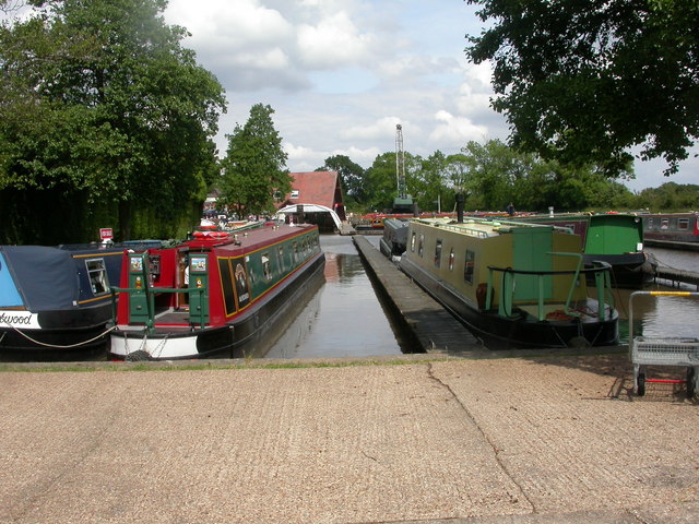
The walk starts at the canal marina in the village, just to the west of the train station. You then head north along the towpath to the Bittell Reservoirs, with views of the River Arrow on the way. At the upper reservoir you pick up the North Worcestershire Path and follow it west to visit the Lickey Hills where there's a visitor centre, cafe, woodland trails and fine views over Birmingham from the high points.
Alvechurch Ordnance Survey Map  - view and print off detailed OS map
Alvechurch Open Street Map  - view and print off detailed map
*New* - Walks and Cycle Routes Near Me Map - Waymarked Routes and Mountain Bike Trails>>
Alvechurch OS Map  - Mobile GPS OS Map with Location tracking
Alvechurch Open Street Map  - Mobile GPS Map with Location tracking
Pubs/Cafes
The Weigh Bridge is located in a great spot next to the canal in the village. You can sit outside in the garden area and watch the boats go by on a summer day. They have a good menu and an excellent selection of ales as a CAMRA award winner. The pub can be found at Scarfield Hill with a postcode of B48 7SQ for your sat navs.
Dog Walking
The canal paths and the woodland in Lickey Hills are great for a dog walk. The Weigh Bridge mentioned above is dog friendly in the outdoor section.
Further Information and Other Local Ideas
Head south along the canal and you can visit the Tardebigge Locks. The noteworthy site is home to the the largest flight of locks in Britain and a small reservoir.
Head south into Redditch and you could enjoy lakeside paths and a walk along the River Arrow in the pretty Arrow Valley Country Park.
For more walking ideas in the area see the Worcestershire Walks page.
Cycle Routes and Walking Routes Nearby
Photos
St Laurence's parish church, Alvechurch, Worcestershire, seen from the southwest. The Gothic Survival west tower was built in 1676.
'The Mill' in Alvechurch, Worcestershire. 'The Mill' on the Radford Road in Alvechurch, Worcestershire is now a restaurant and is situated in the grounds of what was once the Bishop of Worcester's Palace. The road to the left leads towards Wetheroak and to the village centre to the right (past the Social Club).
Barnt Green Sailing Club, Upper Bittell Reservoir. Upper Bittell Reservoir was constructed in the early 19th century to supply the Worcester & Birmingham Canal. Today the reservoir is home to the Barnt Green Sailing Club. General public access is restricted - a public footpath runs across the dam, from which this photo was taken. Access to the east bank is restricted as this is a SSSI.
Lower Bittell Reservoir. Looking south from Bittell Farm Road which separates the lower part of the reservoir from Mill Shrub Pool. This reservoir was built in 1837 along with the neighbouring Upper Bittell Reservoir, in the valley of the River Arrow, to supply the Worcester and Birmingham Canal. The Lower reservoir acts as a compensation reservoir, and is used for private fishing. There is no general public access.


