Arlesey Walks - Along the River Hiz
![]()
![]() This small town in Bedfordshire is located close to two rivers where you can enjoy some easy waterside walking.
This small town in Bedfordshire is located close to two rivers where you can enjoy some easy waterside walking.
The settlements of Letchworth, Hitchin and Biggleswade are also nearby.
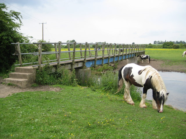
This walk from the village takes you north along the River Hiz to Church End. You'll pass through the pretty Old Moat Nature Reserve which was associated with the old manor of Arlesey Manor. There's woodland and grassy glades here with lots of flora and fauna to look out for. Keep your eyes peeled for kingfisher, chiffchaff, willow warbler, dragonflies and frogs as you make your way through the area. The path forms part of the Hicca Way, a long distance trail that can be followed all the way to Hitchin.
Start the walk in the village and then head west to cross the river. You can then follow a riverside footpath north to Church End where there's some woodland and the Arlesey Bridge railway station.
At the end of the walk you could pick up the Kingfisher Way and follow the waymarked footpath north towards Henlow and the River Ivel.
Arlesey Ordnance Survey Map  - view and print off detailed OS map
Arlesey Open Street Map  - view and print off detailed map
Arlesey OS Map  - Mobile GPS OS Map with Location tracking
Arlesey Open Street Map  - Mobile GPS Map with Location tracking
Walks near Arlesey
- Letchworth - Letchworth Garden City is located in Hertfordshire near to Hitchin and Stevenage
- Hitchin - The Hertfordshire town of Hitchin makes a great base for exploring the lovely north eastern corner of the Chiltern Hills.
This walk visits the nearby Pegsdon Hills using a number of the waymarked long distance trails which pass through the area surrounding the town - Biggleswade - This market town in Bedfordshire has fine trails along the peaceful River Ivel and some attractive local countryside to explore.
- Kingfisher Way - This is a delightful walk along the River Ivel from Baldock to Roxton
- Icknield Way Path - The Icknield Way Path starts at Ivinghoe Beacon in Buckinghamshire and heads to Knettishall Heath in Suffolk along prehistoric pathways
- Barton Hills - Visit the Barton Hills National Nature Reserve and enjoy peaceful walking trails in the Chilterns
- Stevenage Outer Orbital Path - This well maintained walking path circles Stevenage in Hertfordshire and is known as the Stevenage Outer Orbital Path
- Stotfold - This is a lovely riverside walk to the picturesque Stotfold Mill in Bedfordshire near Baldock and Letchworth.
- Baldock - This walk from Baldock visits two pretty nature reserves along the River Ivel which flows through the area
- Ashwell - This pretty village in North Hertfordshire has some nice country trails along the scarp of the Icknield Way Path
- Rowney Warren Wood - These woods in Bedfordshire have walking trails, a BMX trail and mountain bike trails to try
- Maulden Woods - Enjoy miles of nice woodland walking trails in this popular wood in Maulden, Bedfordshire
- Chicksands Wood - These woods in central Bedfordshire have some good walking trails to try
- Clophill and Haynes Circular Walk - A circular walk visiting the settlements of Clophill and Haynes in Bedfordshire
- John Bunyan Trail - Follow in the footsteps of John Bunyan, the Puritan Evangelist and author of the book 'Pilgrim's Progress'
- Ickleford River and Nature Reserve Circular Walk - This attractive Hertfordshire based village is located just north of Hitchin on the west bank of the River Hiz
- Henlow - This Bedfordshire based village is known for its 12th century church and the Champneys Health farm which is used by the rich and famous
- Pirton - This Hertfordshire based village is surrounded by some lovely Chilterns countryside which you can explore on two significant long distance trails.
Pubs/Cafes
The White Horse can be found on the High Street at postcode SG15 6TA. The pub is set in a fine old thatched house formed from three old cottages dating back to 1805. There's a car park here and a nice large garden area. They are dog friendly.
Further Information and Other Local Ideas
Just to the east you could visit the delightful Stotfold Mill on the River Ivel. The historic mill includes a nature reserve positioned on the long distance Kingfisher Way. The restored Grade II listed mill also includes a 4.4 metre wide corn mill waterwheel which is the widest in the country. On open days you can explore the 3 floors of the watermill and learn all about the history of the milling process.
To the west the John Bunyan Trail can be picked up around Shefford.
A few miles to the west there's Silsoe where you can enjoy easy trails around Wrest Park. There's 92 acres of landscaped early eighteenth-century gardens to explore here. You can also enjoy a pleasant stroll around Silsoe village where there are a number of historic properties associated with the park estate.
For more walking ideas in the area see the Chilterns Walks and the Bedfordshire Walks pages.


