Henlow River Walk
![]()
![]() This Bedfordshire based village is known for its 12th century church and the Champneys Health farm which is used by the rich and famous. For walkers there are some lovely riverside trails to follow along the River Ivel and River Hiz.
This Bedfordshire based village is known for its 12th century church and the Champneys Health farm which is used by the rich and famous. For walkers there are some lovely riverside trails to follow along the River Ivel and River Hiz.
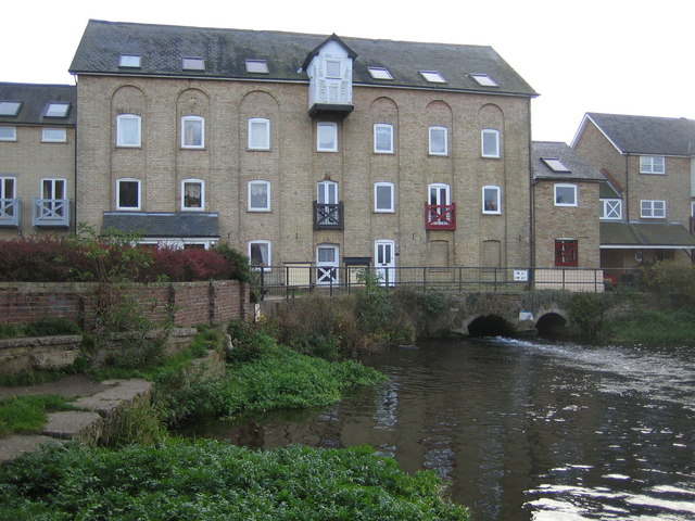
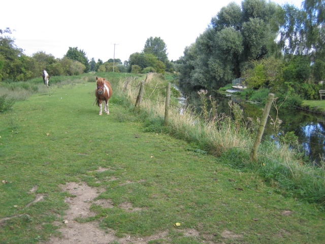
This walk from the village follows a section of the Kingfisher Way along the River Ivel to the neighbouring village of Langford. On the way there's nice country views, lots of water loving wildlife and the picturesque Langford Mill to admire. You can extend the walk by continuing north along the river to Biggleswade.
You can continue your walking in the area by picking up the Henlow Bridge Lakes Circular Walk where you can enjoy more waterside trails along a series of pretty lakes. Champneys Health farm is also located in this area. There's some nice trails here along the River Hiz towards Arlesey.
Postcode
SG16 6AA - Please note: Postcode may be approximate for some rural locationsHenlow River Walk Ordnance Survey Map  - view and print off detailed OS map
Henlow River Walk Open Street Map  - view and print off detailed map
*New* - Walks and Cycle Routes Near Me Map - Waymarked Routes and Mountain Bike Trails>>
Henlow River Walk OS Map  - Mobile GPS OS Map with Location tracking
Henlow River Walk Open Street Map  - Mobile GPS Map with Location tracking
Walks near Henlow River Walk
- Kingfisher Way - This is a delightful walk along the River Ivel from Baldock to Roxton
- Arlesey - This small town in Bedfordshire is located close to two rivers where you can enjoy some easy waterside walking.
- Letchworth - Letchworth Garden City is located in Hertfordshire near to Hitchin and Stevenage
- Hitchin - The Hertfordshire town of Hitchin makes a great base for exploring the lovely north eastern corner of the Chiltern Hills.
This walk visits the nearby Pegsdon Hills using a number of the waymarked long distance trails which pass through the area surrounding the town - Biggleswade - This market town in Bedfordshire has fine trails along the peaceful River Ivel and some attractive local countryside to explore.
- Barton Hills - Visit the Barton Hills National Nature Reserve and enjoy peaceful walking trails in the Chilterns
- Stevenage Outer Orbital Path - This well maintained walking path circles Stevenage in Hertfordshire and is known as the Stevenage Outer Orbital Path
- Stotfold - This is a lovely riverside walk to the picturesque Stotfold Mill in Bedfordshire near Baldock and Letchworth.
- Baldock - This walk from Baldock visits two pretty nature reserves along the River Ivel which flows through the area
- Ashwell - This pretty village in North Hertfordshire has some nice country trails along the scarp of the Icknield Way Path
- Rowney Warren Wood - These woods in Bedfordshire have walking trails, a BMX trail and mountain bike trails to try
- Maulden Woods - Enjoy miles of nice woodland walking trails in this popular wood in Maulden, Bedfordshire
- Chicksands Wood - These woods in central Bedfordshire have some good walking trails to try
- Clophill and Haynes Circular Walk - A circular walk visiting the settlements of Clophill and Haynes in Bedfordshire
- John Bunyan Trail - Follow in the footsteps of John Bunyan, the Puritan Evangelist and author of the book 'Pilgrim's Progress'
- Ickleford River and Nature Reserve Circular Walk - This attractive Hertfordshire based village is located just north of Hitchin on the west bank of the River Hiz
- Icknield Way Path - The Icknield Way Path starts at Ivinghoe Beacon in Buckinghamshire and heads to Knettishall Heath in Suffolk along prehistoric pathways
- Pirton - This Hertfordshire based village is surrounded by some lovely Chilterns countryside which you can explore on two significant long distance trails.
- Langford Baulk Woods Circular Walk - This is a nice peaceful woodland walk in the Bedfordshire village of Langford.
Pubs/Cafes
Head to the Engineer's Arms for some post walk refreshment. The pub dates from 1830 and serves a fine range of ales. Celebrities can sometimes be seen in the pub, coming from the nearby Champneys Health farm. You can find them at 68 High Street, SG16 6AA.
Dog Walking
The river paths make for a pleasant dog walk and the Engineer's Arms mentioned above is also dog friendly.
Further Information and Other Local Ideas
Just to the south west there's Silsoe where you can enjoy easy trails around Wrest Park. There's 92 acres of landscaped early eighteenth-century gardens to explore here. You can also enjoy a pleasant stroll around Silsoe village where there are a number of historic properties associated with the park estate.
For more walking ideas in the area see the Bedfordshire Walks page.
Photos
Village centre, Henlow, Beds. View of the Rotunda and village sign, with the Five Bells public house in the right background.


