Aylsham Walk
![]()
![]() Aylsham is an attractive market town located in North Norfolk. There are a number of waymarked walking trails to follow through the surrounding area, including two popular rail trails. There's also some nice footpaths along the River Bure and through the nearby Blickling Estate.
Aylsham is an attractive market town located in North Norfolk. There are a number of waymarked walking trails to follow through the surrounding area, including two popular rail trails. There's also some nice footpaths along the River Bure and through the nearby Blickling Estate.
This circular walk from the town visits Blickling Hall and the Marriot's Way with some lovely countryside scenery to enjoy.
The walk starts in the town and follows country lanes north west to pick up the Weavers' Way. You can follow the trail north up to Blickling Hall and the lake. The historic Jacobean Hall is surrounded by woodland, farmland, parkland and gardens. It includes three colour coded, way-marked walks and a lovely family cycle route around the 1 mile long lake.
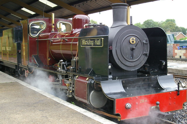
The route then backtracks before heading south west to link up with the Marriot's Way. This trail runs all the way to Norwich along dismantled railway lines with views of the River Wensum Valley. You can follow this trail east back into the town, passing the heritage Bure Valley Railway. There's also some 18th century houses, the old market place and a number of historical buildings to see as you make your way through the town.
Aylsham Ordnance Survey Map  - view and print off detailed OS map
Aylsham Open Street Map  - view and print off detailed map
Aylsham OS Map  - Mobile GPS OS Map with Location tracking
Aylsham Open Street Map  - Mobile GPS Map with Location tracking
Pubs/Cafes
You could stop off at the Whistlestop Café at Aylsham Station where you can enjoy freshly baked cakes and sweet treats, hot and cold drinks, tea and fresh bean coffee, sandwiches, light snacks and ice creams. It's a nice place to enjoy a meal and watch the heritage steam trains come and go. The station cafe is very dog friendly and will provide water bowls if you have your canine friend with you.
Further Information and Other Local Ideas
The Bure Valley Path starts in Aylsham and runs to nearby Wroxham. The shared cycling and walking trail runs along the Bure Valley Railway which is one of the highlights of the area. In Wroxham you can pick up the Hoveton Walk which visits the nearby Hoveton Hall. The 19th century house includes some beautiful grounds with stunning gardens, a pretty lake and popular snowdrop walks in February.
Just to the south of the town there's some nice woodland and heathland trails around Marsham Heath.
To the north west of the Blickling Estate there's Mannington Hall and Gardens near Itteringham. The historic house is surrounded by lovely parkland with delightful gardens, woodland and a lake to see. The 18th century Wolterton Hall can also be visited in this area
For more walking ideas in the area see the Norfolk Walks page.
Cycle Routes and Walking Routes Nearby
Photos
Aylsham Mill. Rear elevation of Aylsham Mill seen from downstream, taken before the change of ownership. More information about the mill can be found here:


