Hoveton Walks
![]()
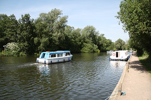
![]() This pretty village is located in the Norfolk Broads, on the other side of the River Bure to its near neighbour of Wroxham.
This pretty village is located in the Norfolk Broads, on the other side of the River Bure to its near neighbour of Wroxham.
This circular walk takes you to the nearby Hoveton Hall. The route uses a section of the Bure Valley Path and a series of country lanes to explore the area to the north of the village. On the way you will pass the historic hall which is well worth a visit. The regency style house dates back to the early 19th century and is surrounded by beautiful gardens, peaceful woodland and arable land. Highlights include the lovely Magnolia Lake and the rhododendrons in the woodland. During February you can also book for the popular snowdrop walks.
Hoveton Ordnance Survey Map  - view and print off detailed OS map
Hoveton Open Street Map  - view and print off detailed map
Hoveton OS Map  - Mobile GPS OS Map with Location tracking
Hoveton Open Street Map  - Mobile GPS Map with Location tracking
Walks near Hoveton
- Wroxham - This delightful Norfolk town has some nice walking trails to follow along the River Bure in the town centre
- Bure Valley Path - This walk and cycle track runs along Bure Valley Railway, and the River Bure from Aylsham to Wroxham
- Weavers' Way - Follow the Weavers' Way through the beautiful Norfolk Broads from Cromer to Great Yarmouth via North Walsham
- Blickling Hall - The Blickling Hall estate in Aylsham has five thousand acres of parkland, farmland and woodland to explore on foot or by bike.
- Marriot's Way - This wonderful cycle and walking path runs from Aylsham to Norwich along the trackbeds of two former railway lines
- How Hill - This walk takes you through the area around How Hill House in the Norfolk Broads
- Ranworth Broad - This circular walk in the Norfolk Broads visits the lovely village of Ranworth and its adjacent broad.
- Coltishall - This pretty riverside village is located in a lovely spot on the River Bure in the Norfolk Broads
- Horning - This Norfolk Broads village has some lovely waterside walks along the River Bure and the surrounding broads
- Barton Broad Boardwalk - This walk takes you to the lovely Barton Broad Boardwalk where you can follow the accessible path through swampy woodland and enjoy wonderful views across Barton Broad.
- Marsham Heath - This circular walk visits the Cawston and Marsham Heaths near Aylsham and Norwich in Norfolk.
- Salhouse Broad - This walk visits Salhouse Broad in the Norfolk Broads National Park
- Heydon Hall - This walk visits the delightful Norfolk village of Heydon
- Mannington Hall - This circular walk visits Mannington Hall and Gardens near Itteringham in Norfolk.
Photos
Hoveton Hall was built between 1809 and 1812 by Humphry Repton and his son John Adey Repton. In the 1940s the parkland was ploughed in order to provide food during the war years and most trees were felled. In 1993 the arable sections of the park were re-grassed; presently the grounds encompass 15 acres of formal gardens, lakes and woodland. Hoveton Hall and gardens has been owned by members of the Buxton family since 1946.
Flowerbeds in the Spider Garden. Flowerbeds in the Spider Garden. The layout of the Spider Garden, so called because of its wrought iron entrance gate depicting a spider in its net, has not changed since the 1840s. The gate was made by Eric Stevenson of Wroxham in 1936; he later became known for his wrought iron work in ten English cathedrals. The gate is nicely complemented by a circular spider web, laid out in flint, created in 1998 by landscape gardener James Smith. This walled garden covers an area of one acre.


