Badger Dingle Waterfall Walk
![]()
![]() This walk visits the delightful Badger Dingle Waterfall in the Shropshire village of Badger.
This walk visits the delightful Badger Dingle Waterfall in the Shropshire village of Badger.
The area is a bit of a hidden gem with peaceful woodland, pools, streams and a picturesque waterfall to admire.
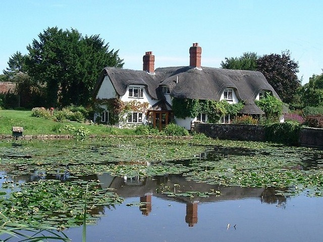
You'll find the dingle just south of the little village which has some pretty thatched cottages and two large ponds. There's nice footpaths running west along the Snowdon Brook, passing the pools and some interesting sandstone outcrops on the way. There's also a Doric Temple on the eastern side of the site.
Postcode
WV6 7JX - Please note: Postcode may be approximate for some rural locationsBadger Dingle Ordnance Survey Map  - view and print off detailed OS map
Badger Dingle Open Street Map  - view and print off detailed map
*New* - Walks and Cycle Routes Near Me Map - Waymarked Routes and Mountain Bike Trails>>
Badger Dingle OS Map  - Mobile GPS OS Map with Location tracking
Badger Dingle Open Street Map  - Mobile GPS Map with Location tracking
Further Information and Other Local Ideas
If you head north to Beckbury you can pick up the epic Monarch's Way. The long distance footpath can be followed towards Albrighton or Telford.
Just to the north of Telford there's the lovely Aqualate Mere to explore. There's a pleasant waterside path to pick up at this large, scenic lake. The site is one of the area's highlights and notable as the largest natural lake in the English Midlands. Just to the west of here there's the interesting market town of Newport where you can enjoy another waterside stroll along the old Newport Canal.
A few miles south there's Worfield where you can enjoy some pleasant trails through the valley of the River Worfe. The historic village is also worthy of exploration with its Saxon church, half timbered houses and the 18th century Davenport House.
Cycle Routes and Walking Routes Nearby
Photos
A cascade in Badger Dingle. In the late 18th and early 19th Century, Sir Isaac Hawkins Browne, an iron and coal magnate who owned the Badger Hall estate, hired William Emes, a pupil of Capability Brown, to create a picturesque landscape in the sandstone gorge of the Dingle. Paths were laid and the brook that runs through the Dingle was dammed to form a series of pools with a rotunda at one end and a boathouse at the other. Today most of it has gone or been overgrown but there are still two small cascades below the dammed pond. This photo shows the lower, more natural cascade, the upper one being a series of steps.


