Worfield Walks
![]()
![]() This little Shropshire village has some pleasant walks through the River Worfe Valley to try. The historic settlement also includes some ancient timber framed buildings, a noteworthy Saxon church and views of the Davenport House Estate. It's located just east of Bridgnorth on the opposite side of the River Severn.
This little Shropshire village has some pleasant walks through the River Worfe Valley to try. The historic settlement also includes some ancient timber framed buildings, a noteworthy Saxon church and views of the Davenport House Estate. It's located just east of Bridgnorth on the opposite side of the River Severn.
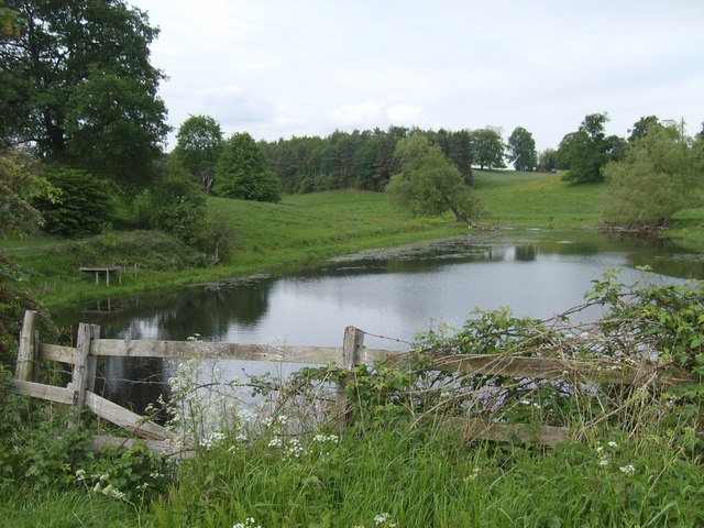
This circular walk from the village first takes you past the old Davenport House to Burcote. You'll then visit the weir on the River Worfe before heading to Soudley Rocks, Rindleford and Bromley. The final section passes Worfield Mere and Hallon just west of the village.
Worfield Ordnance Survey Map  - view and print off detailed OS map
Worfield Open Street Map  - view and print off detailed map
Worfield OS Map  - Mobile GPS OS Map with Location tracking
Worfield Open Street Map  - Mobile GPS Map with Location tracking
Walks near Worfield
- Bridgnorth - This fine Shropshire town has some fine walking trails through the Severn Valley and a number of local parks and gardens to explore.
This long walk from the town centre makes use of the Severn Way and Geopark Way long distance trails to take you on a tour of the countryside to the south of the town - Severn Valley Country Park - This 126-acre riverside park consists of woodland, meadows and riverside banks with views of the River Severn
- Severn Valley Railway Walk - Enjoy a lovely walk along the Severn Valley Railway on this riverside trail in Bewdley
- Dudmaston Hall - This 17th-century country house in the Severn Valley is surrounded by landscaped gardens, parkland, managed woodlands, lakes and farmland.
- Stanmore Country Park Shropshire - This 100 acre country park near Bridgnorth is ideal for a peaceful afternoon stroll
- Sabrina Way - This route is part of the National Bridleroute Network and primarily designed for horse riders but can be used by walkers and cyclists also
- Wyre Forest - This large forest near Bewdley has miles of super cycling and walking trails to enjoy
- Badger Dingle - This walk visits the delightful Badger Dingle Waterfall in the Shropshire village of Badger.
- Albrighton - This large Shropshire based village is located close to Telford and Bridgnorth
- Hampton Loade - This pretty riverside village is located on the Severn Valley Railway in Shropshire
- Button Oak - This circular walk visits the village of Button Oak in the Wyre Forest near Bewdley.
- Comer Woods - This walk explores Comer Woods in Shropshire
- Severn Way - Follow the River Severn from its source at Plynlimon in Powys, to Bristol, the mouth of the river
- Geopark Way - Meandering its way for 109 miles through the Abberley and Malvern Hills Geopark from Bridgnorth to Gloucester, the Geopark Way passes through stunning countryside as it explores 700 million years of geological history
- Jack Mytton Way - This is a splendid walk or mountain bike ride through Shropshire from Cleobury Mortimer to Llanfair Waterdine
Further Information and Other Local Ideas
Just 3 miles to the north there's something of a hidden gem at Badger Dingle. There's a delightful little wood here with a brook, pools, sandstone outcrops and a rushing waterfall to admire.
For more walking ideas in the area see the Shropshire Walks page.
Photos
Worfield churchyard. The church dates back to the 12th century and is perhaps best known for its fine spire. Although there have been changes to the church over the centuries some of its original features still remain. The original wooden doors leading into the church date back to the 12th Century.
Dove tower at Davenport House. The house is a Grade I listed building built around 1727. It was built by the architect Francis Smith of Warwick for Henry Davenport. It is now used for events such as weddings, conferences and private parties.


