Bishopsteignton Walks
![]()
![]() This pretty village is located on the River Teign Estuary between the more well known settelments of Teignmouth and Newton Abbot.
This pretty village is located on the River Teign Estuary between the more well known settelments of Teignmouth and Newton Abbot.
The historic settlement includes a small museum, the ruins of a 14th century chapel and a fine 16th century pub to relax in after your exercise.
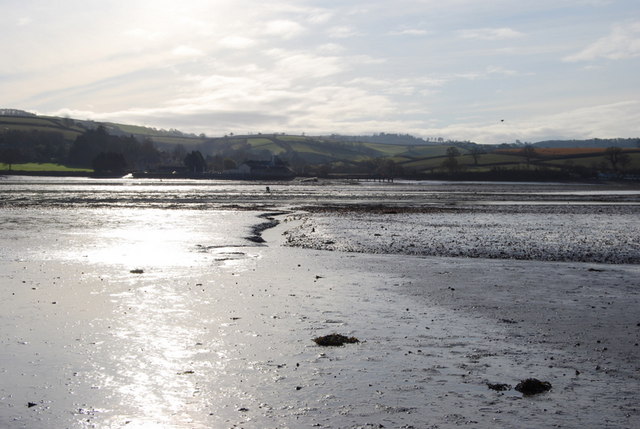
This walk from the village takes you down to the estuary. You can follow a public footpath south down to Luxton's Steps, crossing the railway line as you go. You can then walk along the beach at Red Rock and enjoy a view over the river towards Shaldon and the Coombe Cellars pub on the opposite side.
To continue your walking from the village head north to visit Little Haldon Heath. There's some nice heathland trails and lots of interesting flora and fauna to see here. You can find the heath a couple of miles north of the village. There is a National Trust car park which can be found at postcode TQ13 0BW for your sat navs.
Postcode
TQ14 9RF - Please note: Postcode may be approximate for some rural locationsBishopsteignton Ordnance Survey Map  - view and print off detailed OS map
Bishopsteignton Open Street Map  - view and print off detailed map
Bishopsteignton OS Map  - Mobile GPS OS Map with Location tracking
Bishopsteignton Open Street Map  - Mobile GPS Map with Location tracking
Walks near Bishopsteignton
- Teignmouth to Dawlish Railway Walk - This popular coastal walk follows the South Devon Railway Sea Wall from Teignmouth to Dawlish
- Newton Abbot - This attractive market town has a number of good options for walkers
- Dawlish Sea Wall - Follow the sea wall from Dawlish to Dawlish Warren on this lovely coastal walk
- Teignmouth and Dawlish Way - These two lovely coastal towns are connected by this popular walk devised by Teignmouth and Dawlish Ramblers
- Labrador Bay - This walk visits the lovely Labrador Bay nature reserve and coastal viewpoint near Shaldon in Devon.
- Stover Country Park - Explore over 114 acres of woodland, heathland, grassland and lakes on this circular walk through the peaceful Stover Country Park, near Newton Abbot in Devon
- Templer Way - Follow the Templer Way from Haytor on Dartmoor to the seaport of Teignmouth via Newton Abbot
- Stover Canal - Follow the Stover Canal from Newton Abbot to Teigngrace on this short walk in South Devon
- Decoy Country Park - This is a short walk around the delightful Decoy Country Park in Newton Abbot, Devon
- River Teign Walk - This walk explores the beautiful Teign Valley, following the River Teign from its source on Dartmoor to Shaldon on the Devon coast
- Ideford Common - This area of common land near Newton Abbot has some nice footpaths to try
- Chudleigh - This Devon based town is located in a good spot close to the Dartmoor National Park and the River Teign Valley.
- Scorhill Stone Circle - This walk visits the Scorhill Stone Circle and the Wallabrook Clapper Bridge in the Teign Valley of Dartmoor.
- Shaldon - This pretty South Devon village is in a lovely location on the River Teign Estuary
- River Lemon - This waterside walk takes you along the River Lemon from Newton Abbot to Bickington in Devon.
Pubs/Cafes
Back in the village you can enjoy some post walk refreshments at the 16th century Cockhaven Arms. The pub includes a lovely garden area overlooking the estuary. You can find them on Cockhaven Road with postcode TQ14 9RF for your sat navs.
Photos
Bishopsteignton footpath. The footpath from the village leading down to the River Teign. This ancient footpath leads to the point where villagers could ford the river at low tide to reach Coombe Cellars, a public house on the south bank of the river.
Trains by the Teign. A pair of trains pass each other on the stretch of track between Luxton's Steps (from where the photo was taken) and Flow Point on the north side of the Teign estuary.
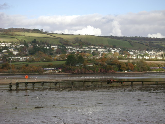
Luxton's Step from Coombe Cellars. The landing stage leads to Coombe Cellars, destination pub, out of shot, right. Across the Teign estuary is Luxton's Step, where shanties huddle between the trains and the tides; Bishopsteignton beyond.
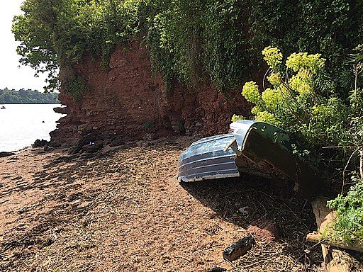
Broken boat at Luxton's Steps. The green flowers are a garden Euphorbia or spurge, probably wulfenii. The colour perfectly complements the red of the low cliff of Teignmouth Breccia (or possibly Watcombe Conglomerate). Old maps consistently call the place Luxton's Steps although the 1:25 000 map of 2005 calls it Luxton's Step. At the top of the steps down to the beach is a sign relating the modern history of the place, calling it Luxton Steps. A fuzzy view from across the river is here.


