Walks in Blackburn
![]()
![]() This Lancashire town has some nice canal trails, a local country park, several reservoirs and a significant hill to visit.
This Lancashire town has some nice canal trails, a local country park, several reservoirs and a significant hill to visit.
This walk from the town visits some of the local highlights including the Leeds and Liverpool Canal the Darwen Tower and Sunnyhurst Woods.
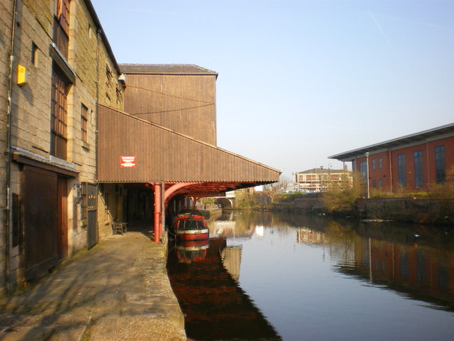
The walk starts from Blackburn train station where it's just a short stroll to the canal. You can then pick up the towpath and follow it south west through Lower Audley, Grimshaw Park, Nova Scotia, Moorgate and Mill Hill. Around here you leave the canal to pick up the Witton Weavers Way which you can follow south towards Tockholes. In this area you could take a short detour to the south to visit the pretty Roddlesworth Reservoir. This route heads past Earnsdale Reservoir before climbing to the Darwen or Jubilee Tower. You can climb the tower for wonderful views of the Bowland Fells, North Yorkshire, Morecambe Bay, Blackpool Tower, the Lake District and the Isle of Man. Near the foot of the hill you can also pay a visit to Bold Venture Park.
After taking in the views the route descends to Sunnyhurst Wood. Follow the woodland trails through the woods and you will emerge in Darwen where you can walk through the town to the train station. Here you can catch the train back to Blackburn.
Please scroll down for the full list of walks near and around Blackburn. The detailed maps below also show a range of footpaths, bridleways and cycle paths in the area.
Blackburn Ordnance Survey Map  - view and print off detailed OS map
Blackburn Open Street Map  - view and print off detailed map
*New* - Walks and Cycle Routes Near Me Map - Waymarked Routes and Mountain Bike Trails>>
Blackburn OS Map  - Mobile GPS OS Map with Location tracking
Blackburn Open Street Map  - Mobile GPS Map with Location tracking
Walks near Blackburn
- Leeds and Liverpool Canal - Enjoy waterside cycling and walking along Britain's longest single canal
- Darwen Tower - This circular walk takes you up Darwen Hill to Jubilee Tower from Tockholes in Lancashire
- Roddlesworth Reservoir - Enjoy a circular walk around these pretty reservoirs near Darwen in Lancashire
- Sunnyhurst Woods - Explores 85 acres of woodland on this circular walk through Sunnyhurst Woods in Darwen
- Witton Country Park - This country park in Blackburn boasts nearly 500 acres of mixed woodland, parkland, grassland and farmland.
- Witton Weavers Way - This circular walk starts and finishes in Witton Park near Blackburn
- Bold Venture Park Darwen - This large park in Darwen is great for an easy afternoon stroll
- Tockholes - This area in the West Pennine Moors is a popular place for walkers with woodland trails, reservoirs and a fantastic hill climbs to try.
- Accrington - This Lancashire based town has some nice canalside trails and a nature trail in nearby Woodnook
- Fishmoor Reservoir - This reservoir in Blackburn is a nice place for an easy stroll in the town.
- Oswaldtwistle - This Lancashire based town is located between Accrington and Blackburn in the Hyndburn borough of the county.
- Haslingden - This walk climbs to an interesting art structure and viewpoint in Haslingden, Lancashire
- Great Hill - This circular walk climbs to Great Hill near Blackburn in Lancashire.
Further Information and Other Local Ideas
On the western side of the town there's some nice trails around Witton Country Park. Here you'll find 500 acres of mixed woodland, parkland, grassland and farmland.
The Accrington Walk visits Blackburn from the neighbouring town, following the canal towpath for most of the way.
For more walking ideas in the area see the Lancashire Walks and the West Pennine Moors Walks pages.


