Oswaldtwistle Moor Walk with OS Map
![]()
![]() This Lancashire based town is located between Accrington and Blackburn in the Hyndburn borough of the county.
This Lancashire based town is located between Accrington and Blackburn in the Hyndburn borough of the county.
The Leeds and Liverpool Canal runs just to the north providing good local walking and cycling opportunities along the easy towpath. A popular circular walk in the area is the Fairy Caves Walk which will take you along the canal to a battery of coke ovens that are part of Lancashire’s industrial past.
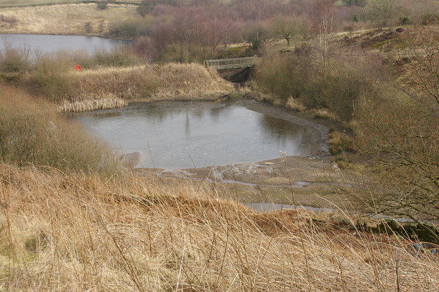
This walk takes you south to Oswaldtwistle Moor and Haslingden Moor which form part of the wider West Pennine Moors. At the southern end of the walk you'll also enjoy a pleasant waterside trail around Calf Hey Reservoir using a section of the long distance Rossendale Way.
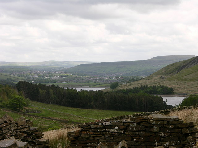
On the way there's wonderful views across the beautiful Valley of Haslingden Grane and the photogenic Oswaldtwistle Wind Farm to admire.
Please scroll down for the full list of walks near and around Oswaldtwistle. The detailed maps below also show a range of footpaths, bridleways and cycle paths in the area.
Oswaldtwistle Ordnance Survey Map  - view and print off detailed OS map
Oswaldtwistle Open Street Map  - view and print off detailed map
*New* - Walks and Cycle Routes Near Me Map - Waymarked Routes and Mountain Bike Trails>>
Oswaldtwistle OS Map  - Mobile GPS OS Map with Location tracking
Oswaldtwistle Open Street Map  - Mobile GPS Map with Location tracking
Walks near Oswaldtwistle
- Accrington - This Lancashire based town has some nice canalside trails and a nature trail in nearby Woodnook
- Blackburn - This Lancashire town has some nice canal trails, a local country park, several reservoirs and a significant hill to visit.
- Haslingden - This walk climbs to an interesting art structure and viewpoint in Haslingden, Lancashire
- Hyndburn Clog - A circular walk around Blackburn and Accrington in Lancashire, visiting a series of reservoirs and the Leeds and Liverpool Canal.
- Calf Hey Reservoir - The attractive area of Haslingden Grane includes some nice walking trails around Calf Hey Reservoir and through the adjacent woodland
- Darwen Tower - This circular walk takes you up Darwen Hill to Jubilee Tower from Tockholes in Lancashire
- Roddlesworth Reservoir - Enjoy a circular walk around these pretty reservoirs near Darwen in Lancashire
- Sunnyhurst Woods - Explores 85 acres of woodland on this circular walk through Sunnyhurst Woods in Darwen
- Witton Country Park - This country park in Blackburn boasts nearly 500 acres of mixed woodland, parkland, grassland and farmland.
- Witton Weavers Way - This circular walk starts and finishes in Witton Park near Blackburn
- Bold Venture Park Darwen - This large park in Darwen is great for an easy afternoon stroll
- Tockholes - This area in the West Pennine Moors is a popular place for walkers with woodland trails, reservoirs and a fantastic hill climbs to try.
- Rossendale Way - This circular walk takes you on a tour of the lovely Rossendale area of Lancashire and Greater Manchester.
The path passes Haslingden, Rawtenstall, Whitworth, Stubbins and Healey with a series of attractive reservoirs including Cowpe and Calf Hey real highlights - Fishmoor Reservoir - This reservoir in Blackburn is a nice place for an easy stroll in the town.
- Haslingden Grane - This area of moorland in Rossendale includes several historic ruined farmhouses and a series of picturesque reservoirs.
- Great Hill - This circular walk climbs to Great Hill near Blackburn in Lancashire.
Photos
Valley of Haslingden Grane. This wonderful glaciated valley includes several historic ruined farmhouses and a series of picturesque reservoirs.


